Toggle navigation
LMEC Home
Exhibitions
Georeferencing
Tools for Teachers
Collections
My Favorites
Sign Up / Log In
Search
Search the map portal
Map Collection
Map Collection
Map Sets
Search
Search
Search for
Search In
All Fields
Creator
Title
Subject
Place
Search All Digital Collections
Advanced Search
8726 Results
My Search
Start Over
More Like
commonwealth:1j92kc44m
Remove constraint More Like: commonwealth:1j92kc44m
Filter your Search
Place
North and Central America
5,957
United States
4,875
Massachusetts
2,110
Europe
1,396
Suffolk (county)
1,077
Boston
1,050
Canada
449
Asia
438
more
Place
»
Topic
Boston (Mass.)--Maps
587
United States--Maps
282
Real property--Massachusetts--Boston--Maps
177
Massachusetts--Maps
162
Landowners--Massachusetts--Boston--Maps
134
North America--Maps--Early works to 1800
103
New England--Maps
102
City planning--Massachusetts--Boston--Maps
93
more
Topic
»
Date
Date range begin
–
Date range end
Current results range from
1482
to
2023
View distribution
Creator
United States. Hydrographic Office
595
O.H. Bailey & Co
148
Des Barres, Joseph F. W. (Joseph Frederick Wallet), 1722-1824
123
United States. Post Office Dept
120
Ptolemy, 2nd cent
100
Boston Redevelopment Authority
94
Walling, Henry Francis, 1825-1888
94
Geological Survey (U.S.)
86
more
Creator
»
Format
Maps/Atlases
8,665
Manuscripts
215
Prints
56
Books
36
Objects/Artifacts
10
Drawings/Illustrations
9
Posters
5
Georeferenced
Yes
870
No
7,856
Collection
Norman B. Leventhal Map & Education Center Collection
8,696
Boston and New England Maps
2,260
Urban Maps
2,049
Maritime Charts and Atlases
1,083
American Revolutionary War-Era Maps
620
Boston Redevelopment Authority Collection
112
William L. Clements Library Collection
3
Mapping Boston Collection
2
more
Collection
»
Available to use
No known restrictions
8,578
Creative Commons license
49
Search Constraints
Sort by relevance
relevance
title
date (asc)
date (desc)
Number of results to display per page
20 per page
10
per page
20
per page
50
per page
100
per page
View results as:
grid view
map view
Search Results
5381.
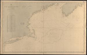
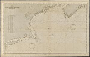
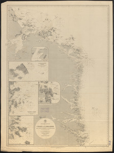
North America, Atlantic coast of the United States, Halifax to New York with southern part of Nova Scotia : compiled from the...
5382.
North America, Atlantic coast of the United States Halifax to New York with southern part of Nova Scotia : compiled from the...
5383.
North America, Bay of Fundy, Grand Manan Island and adjacent coast : from surveys by the British Admiralty in 1855, and by the...
5384.
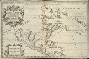
North America divided into its III principall parts : 1st English part viz. English Empire containing ye Articklands near...
5385.
North America, divided into its principall parts where are distinguished the severall states which belong to the English,...
5386.
North America, Dominion of Canada, Gulf of Saint Lawrence, south coast of Quebec from Washtawooka Bay to Cape Mackinnon :...
5387.
North America, Dominion of Canada, Gulf of St. Lawrence, Magdalen Islands : from a British survey in 1833
5388.
North America, Dominion of Canada, Gulf of St. Lawrence, Prince Edward Island and adjacent coasts, from Sea Wolf Island to...
5389.
North America, drawn from the best authorities
5390.
North America, east coast, anchorages on the n.e. coast of Labrador : republication of Brit. Admty. chart no. 225
5391.
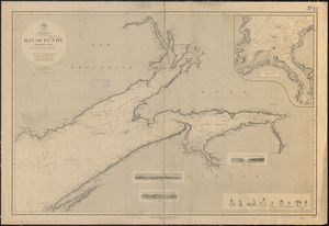
North America, east coast, Bay of Fundy, northern part : from British surveys
5392.
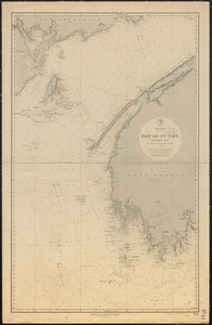
North America, east coast, Bay of Fundy, southern part : from British and United States surveys
5393.
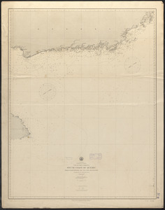
North America, east coast, coast of Labrador from Cape St. Charles to Sandwich Bay : from British surveys to 1882
5394.
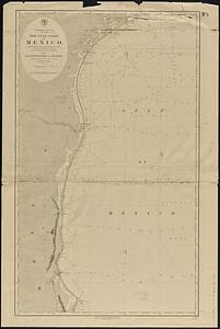
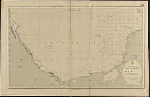
North America, east coast, Gulf of Mexico, the Gulf coast of Mexico, sheet 1 : from the Rio Grande to Cape Roxo
5395.
North America, east coast, Gulf of Mexico, the Gulf coast of Mexico, sheet 2 : from Tampico to Campeche Bank
5396.
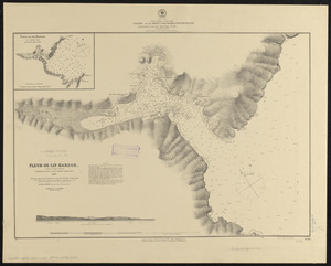
North America, east coast, harbor on the north east coast of Newfoundland : republication of the Brit. Admty. chart no. 281,...
5397.
North America, east coast, harbors on the south coast of Newfoundland : republication of Brit. Admty. charts nos. 2829, 301,...
5398.
North America, east coast, Newfoundland : republication of the Brit. Adm. charts nos. 232a & b
5399.
North America, east coast of Central America, Cape Gracias á Dios to Gulf of Darien : compiled from the latest British surveys...
5400.
North America, east coast of Mexico, Port of Vera Cruz and anchorage of Anton Lizardo : from the latest French, Spanish and...
‹ Prev
Next ›
1
2
…
266
267
268
269
270
271
272
273
274
…
436
437