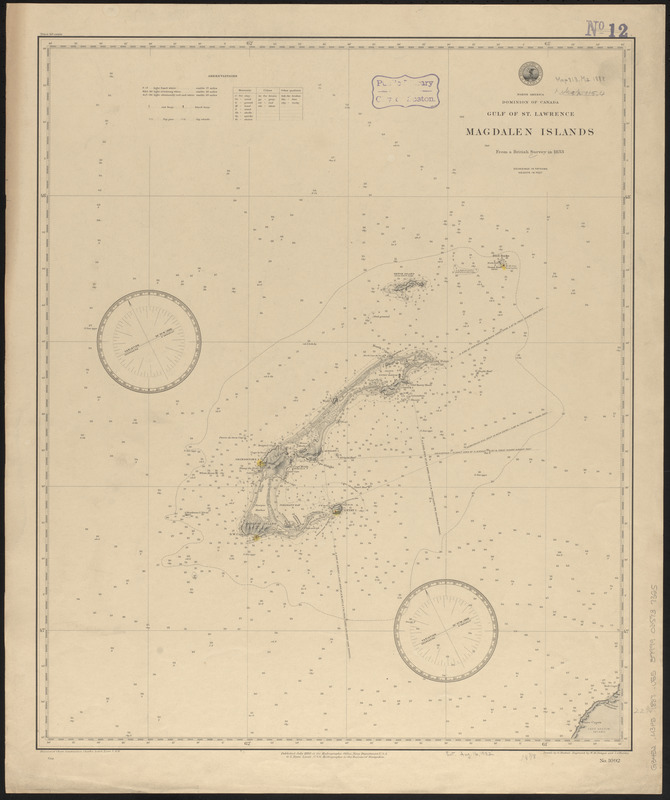
North America, Dominion of Canada, Gulf of St. Lawrence, Magdalen Islands : from a British survey in 1833
Item Information
- Title:
- North America, Dominion of Canada, Gulf of St. Lawrence, Magdalen Islands : from a British survey in 1833
- Title (alt.):
-
Magdalen Islands
- Issuing body:
- United States. Hydrographic Office
- Engraver:
- Dougal, W. M. (William M.)
- Draftsman:
- Noetzel, G. (Gregor)
- Engraver:
- Waddey, J. A. (John A.)
- Name on Item:
-
drawn by G. Noetzel ; engraved by W.M.Dougal and J.A. Waddey
- Date:
-
1888
- Format:
-
Maps/Atlases
- Location:
-
Boston Public Library
Norman B. Leventhal Map & Education Center - Collection (local):
-
Norman B. Leventhal Map & Education Center Collection
- Subjects:
-
Nautical charts--Québec (Province)--Iles-de-la-Madeleine
Iles-de-la-Madeleine (Québec)--Maps
- Places:
-
CanadaQuebec (province)Madeleine, Îles de la (area)
- Extent:
- 1 map : hand colored ; 58 x 48 cm
- Terms of Use:
-
No known copyright restrictions.
No known restrictions on use.
- Publisher:
-
[Washington, D.C.] :
Hydrographic Office
- Scale:
-
Scale approximately 1:305,000
- Language:
-
English
- Notes:
-
Relief shown by hachures and spot heights. Depths shown by soundings and isolines.
- Identifier:
-
06_01_015534
- Call #:
-
G9096.P5 svar .U55
- Barcode:
-
39999085937355