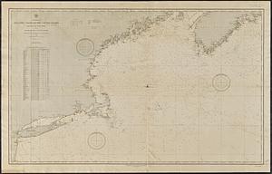
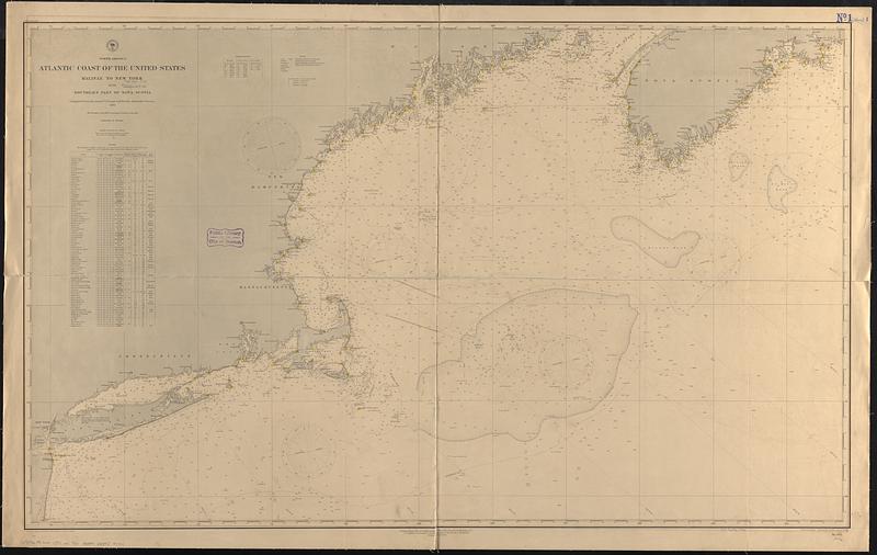
North America, Atlantic coast of the United States, Halifax to New York with southern part of Nova Scotia : compiled from the latest U.S. Coast and British Admiralty Surveys 1886
Item Information
- Title:
- North America, Atlantic coast of the United States, Halifax to New York with southern part of Nova Scotia : compiled from the latest U.S. Coast and British Admiralty Surveys 1886
- Issuing body:
- United States. Hydrographic Office
- Engraver:
- Birch, C. E. (Charles E.)
- Draftsman:
- Dessez, L. (Leon)
- Engraver:
- Waddey, J. A. (John A.)
- Name on Item:
-
drawn by L. Dessez ; engraved by C.E. Birch and J.A. Waddey
- Date:
-
[1889]
- Format:
-
Maps/Atlases
- Genre:
-
Nautical charts
- Location:
-
Boston Public Library
Norman B. Leventhal Map & Education Center - Collection (local):
-
Norman B. Leventhal Map & Education Center Collection
- Subjects:
-
Atlantic Coast (N.S.)--Maps
Atlantic Coast (New England)--Maps
Nautical charts--Nova Scotia
Nautical charts--New England
- Places:
-
CanadaNova Scotia (province)
New England (area)
- Extent:
- 1 map : hand colored ; 75 x 125 cm
- Terms of Use:
-
No known copyright restrictions.
No known restrictions on use.
- Publisher:
-
Washington, D.C. :
Hydrographic Office
- Edition:
- Edition of April 1889
- Scale:
-
Scale approximately 1:760,000
- Language:
-
English
- Notes:
-
Relief shown by hachures and spot heights. Depths shown by soundings and isolines.
Includes list of lights.
- Notes (date):
-
This date is inferred.
- Identifier:
-
06_01_017052
- Call #:
-
G9096.P5 svar .U55 no. 941
- Barcode:
-
39999085953774