Toggle navigation
LMEC Home
Exhibitions
Georeferencing
Tools for Teachers
Collections
My Favorites
Sign Up / Log In
Search
Search the map portal
Map Collection
Map Collection
Map Sets
Search
Search
Search for
Search In
All Fields
Creator
Title
Subject
Place
Search All Digital Collections
Advanced Search
386 Results
My Search
Start Over
More Like
commonwealth:028756753
Remove constraint More Like: commonwealth:028756753
Filter your Search
Place
North and Central America
190
United States
75
Asia
49
Oceania
46
Europe
45
Mexico
28
Japan
23
Canada
21
more
Place
»
Topic
United States Exploring Expedition (1838-1842)
22
Tuamotu Archipelago (French Polynesia)--Maps
10
Coasts--Newfoundland and Labrador--Maps
8
Bahamas--Maps
6
Huron, Lake (Mich. and Ont.)--Maps
6
Mediterranean Sea--Maps
6
Nautical charts--Mediterranean Sea
6
Nautical charts--Ontario, Lake (N.Y. and Ont.)
6
more
Topic
»
Date
Date range begin
–
Date range end
Current results range from
1630
to
1989
View distribution
Creator
United States. Hydrographic Office
236
U.S. Lake Survey
35
United States Exploring Expedition (1838-1842)
27
Wilkes, Charles, 1798-1877
20
J. & C. Walker (Firm)
19
Sherman & Smith
19
Great Britain. Hydrographic Office
17
Dougal, William H., 1822-1895
15
more
Creator
»
Format
Maps/Atlases
386
Prints
5
Georeferenced
No
386
Collection
Norman B. Leventhal Map Center Collection
386
Maritime Charts and Atlases
330
Boston and New England Maps
20
Urban Maps
11
Boston Redevelopment Authority Collection
1
Available to use
No known restrictions
386
Search Constraints
Sort by relevance
relevance
title
date (asc)
date (desc)
Number of results to display per page
20 per page
10
per page
20
per page
50
per page
100
per page
View results as:
grid view
map view
Search Results
1.
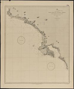
North America, west coast of Central America, Judas Point to Burica Point
2.
Africa
3.
Africa, north coast, Strait of Gibraltar, Ceuta anchorages and approaches : from the French surveys 1855, corrected to 1876
4.
Africa--east coast, coast of Zanzibar, Kiswere Harbor : from a British survey by the officers of H.M.S. Nassau, 1874 :...
5.
Africa--north coast, Strait of Gibraltar, Tangier Bay : from a French survey in 1855 ; republication of the Brit. Admty. chart...
6.
Ahii and Manhii or Peacock and Wilsons Islands
7.
Aleutian Archipelago
8.
Aleutian Archipelago
9.
Aleutian Archipelago
10.
Anchorages in the Fiji Group : from British surveys ; corrected to 1872
11.
L'Anse including Portage Entry and part of Keweenaw Bay, Lake Superior
12.
Apolima, Samoan Group ; Harbour of Oafonu, Isld. of Tutuila, north side ; Harbour of Aur, Isld. of Tutuila, north side ;...
13.
Arabia--Red Sea, Mokha Road : from a British survey in 1882
14.
Asia, east coast, China Sea in four sheets : compiled from the latest surveys 1885
15.
Asia, Japan and Korea with the surrounding seas and the adjacent coastal region of China : from the latest information
16.
Atlantic Ocean, Azores or Western Isles
17.
Atlantic Ocean, Bay of Biscay, ports on the north coast of Spain : from Spanish government surveys, corrected to 1876
18.
Atlantic Ocean, n.w. coast of Africa, Mogador or Zuerah Harbor : from British and French surveys in 1835 & 1852; the south...
19.
Atlas to Marshall's life of Washington
20.
Azores, Corvo and Flores
‹ Prev
Next ›
1
2
3
4
5
…
19
20