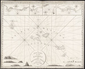
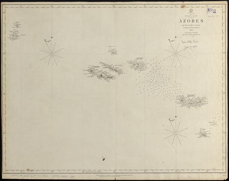
Atlantic Ocean, Azores or Western Isles
Item Information
- Title:
- Atlantic Ocean, Azores or Western Isles
- Cartographer:
- Great Britain. Hydrographic Office
- Surveyor:
- Vidal, A. T. E. (Alexander Thomas Emeric), 1792-1863
- Issuing body:
- Great Britain. Admiralty
- Engraver:
- J. & C. Walker (Firm)
- Name on Item:
-
surveyed by Captn. A.T.E. Vidal R.N., 1843,4 ; J & C. Walker sculpt.
- Date:
-
1849
- Format:
-
Maps/Atlases
- Genre:
-
Nautical charts
- Location:
-
Boston Public Library
Norman B. Leventhal Map & Education Center - Collection (local):
-
Norman B. Leventhal Map & Education Center Collection
- Subjects:
-
Azores--Maps
Nautical charts--Azores
- Places:
-
PortugalAzores (region)
- Extent:
- 1 map ; 46 x 61 cm
- Terms of Use:
-
No known copyright restrictions.
No known restrictions on use.
- Publisher:
-
[London] :
Hydrographic Office of the Admiralty
- Scale:
-
Scale approximately 1:1,000,000
- Language:
-
English
- Table of Contents:
-
Port Ilo Ilo
Port Zebú
Port San Miguel
Port Barreras or Lanang
Port Buluanag or Sta. Ana
- Notes:
-
Relief shown by hachures and spot heights. Depths shown by isolines and soundings.
"Published according to Act of Parliament at the Hydrographic Office of the Admiralty July 26th 1849."
"[Chart] 1950"--Lower right margin.
- Identifier:
-
06_01_017606
- Call #:
-
G9096.P5 svar .G74 no. 1950
- Barcode:
-
39999085961694