Toggle navigation
LMEC Home
Exhibitions
Georeferencing
Tools for Teachers
Collections
My Favorites
Sign Up / Log In
Search
Search the map portal
Map Collection
Map Collection
Map Sets
Search
Search
Search for
Search In
All Fields
Creator
Title
Subject
Place
Search All Digital Collections
Advanced Search
2867 Results
My Search
Start Over
atlas
Remove constraint atlas
Filter your Search
Place
North and Central America
1,663
United States
1,001
Europe
464
Massachusetts
353
Canada
271
South America
191
Asia
190
Suffolk (county)
164
more
Place
»
Topic
Landowners--Massachusetts--Boston--Maps
115
Real property--Massachusetts--Boston--Maps
106
United States--Maps
87
Boston (Mass.)--Maps
64
United States--History--French and Indian War, 1754-1763--Maps
63
Saint Lawrence River--Maps
41
Nautical charts--Early works to 1800
39
North America--Maps--Early works to 1800
36
more
Topic
»
Date
Date range begin
–
Date range end
Current results range from
1482
to
2023
View distribution
Creator
United States. Hydrographic Office
583
Des Barres, Joseph F. W. (Joseph Frederick Wallet), 1722-1824
118
Ptolemy, 2nd cent
100
Bromley, George Washington
99
Bromley, Walter Scott
97
G.W. Bromley & Co.
75
Carey, Mathew, 1760-1839
74
Paullin, Charles Oscar, 1868 or 1869-1944
70
more
Creator
»
Format
Maps/Atlases
2,851
Manuscripts
58
Books
37
Prints
8
Documents
5
Drawings/Illustrations
1
Georeferenced
Yes
142
No
2,725
Collection
Norman B. Leventhal Map & Education Center Collection
2,410
Maritime Charts and Atlases
1,167
American Revolutionary War-Era Maps
504
Boston and New England Maps
382
Urban Maps
255
Massachusetts Real Estate Atlases
144
William L. Clements Library Collection
92
Mapping Boston Collection
61
more
Collection
»
Available to use
No known restrictions
2,316
Creative Commons license
158
Search Constraints
Sort by relevance
relevance
title
date (asc)
date (desc)
Number of results to display per page
20 per page
10
per page
20
per page
50
per page
100
per page
View results as:
grid view
map view
Search Results
1381.
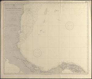
North America, Atlantic coast of the United States, Cape Canaveral to Havana with Straits of Florida and Bahama Banks :...
1382.
North America, Atlantic coast of the United States, Cape Hatteras to Cape Canaveral : compiled from the latest U.S. coast and...
1383.
North America, Atlantic coast of the United States, Halifax to New York with southern part of Nova Scotia : compiled from the...
1384.
North America, Atlantic coast of the United States Halifax to New York with southern part of Nova Scotia : compiled from the...
1385.
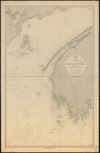
North America, Bay of Fundy, Grand Manan Island and adjacent coast : from surveys by the British Admiralty in 1855, and by the...
1386.
North America, Dominion of Canada, Gulf of Saint Lawrence, south coast of Quebec from Washtawooka Bay to Cape Mackinnon :...
1387.
North America, Dominion of Canada, Gulf of St. Lawrence, Magdalen Islands : from a British survey in 1833
1388.
North America, Dominion of Canada, Gulf of St. Lawrence, Prince Edward Island and adjacent coasts, from Sea Wolf Island to...
1389.
North America, east coast, anchorages on the n.e. coast of Labrador : republication of Brit. Admty. chart no. 225
1390.
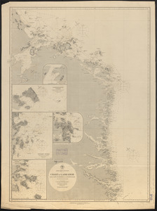
North America, east coast, Bay of Fundy, northern part : from British surveys
1391.
North America, east coast, Bay of Fundy, southern part : from British and United States surveys
1392.
North America, east coast, coast of Labrador from Cape St. Charles to Sandwich Bay : from British surveys to 1882
1393.
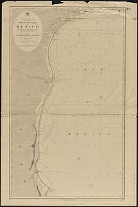
North America, east coast, Gulf of Mexico, the Gulf coast of Mexico, sheet 1 : from the Rio Grande to Cape Roxo
1394.
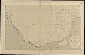
North America, east coast, Gulf of Mexico, the Gulf coast of Mexico, sheet 2 : from Tampico to Campeche Bank
1395.
North America, east coast, harbor on the north east coast of Newfoundland : republication of the Brit. Admty. chart no. 281,...
1396.
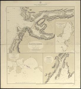
North America, east coast, harbors on the south coast of Newfoundland : republication of Brit. Admty. charts nos. 2829, 301,...
1397.
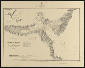
North America, east coast, Newfoundland : republication of the Brit. Adm. charts nos. 232a & b
1398.
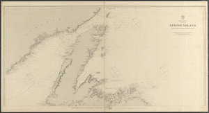
North America, east coast of Central America, Cape Gracias á Dios to Gulf of Darien : compiled from the latest British surveys...
1399.
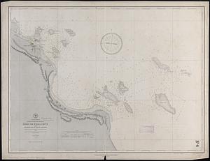
North America, east coast of Mexico, Port of Vera Cruz and anchorage of Anton Lizardo : from the latest French, Spanish and...
1400.
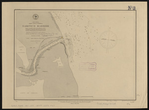
North America, east coast of Mexico, Tampico Harbor : from a survey in 1883 by the officers of the U.S.S. Alliance, Commander...
‹ Prev
Next ›
1
2
…
66
67
68
69
70
71
72
73
74
…
143
144