Search Constraints
Search Results


1455. Canso Harbor
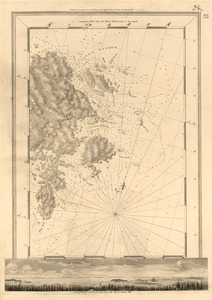
1456. Canso Harbor

1457. Canso Harbor

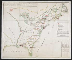
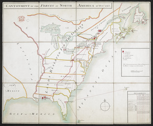
1458. Cantium vernacule Kent


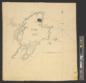
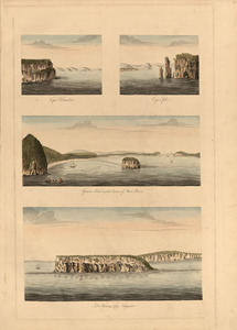
1465. Cape Ann


1470. Cape Cod

1471. Cape Cod and the islands


1473. Cape Cod Bay


1488. Capital Cordoba