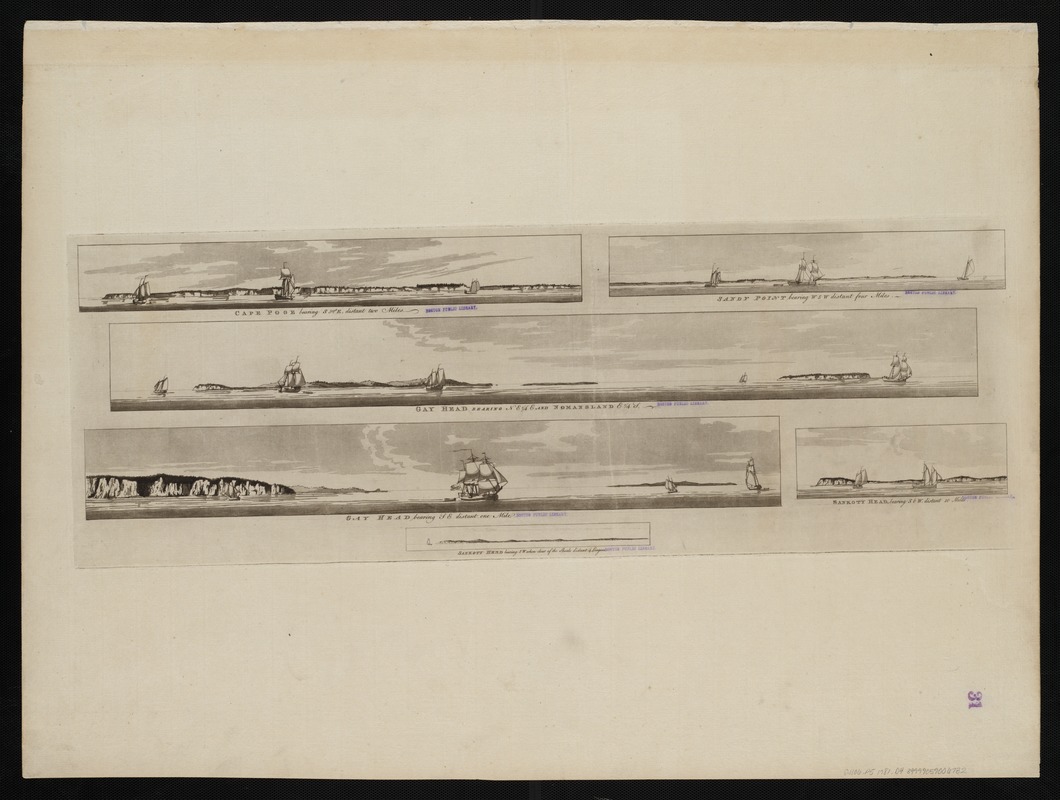
Cape Poge bearing S 52°E, distant 2 miles : Sandy Point bearing W S W distant four miles ; Gay Head bearing N E 1/4 E and Nomansland E 1/4 S ; Gay Head bearing SE distant one mile ; Sankoty Head, bearing S by W, distant 10 miles ; Sankoty Head bearing SW when clear of the shoals distant 4 leagues
This map is also available in American Revolutionary Geographies Online (ARGO), a collections portal especially built for material relating to the American Revolutionary War Era. Visit ARGO to learn more about this item and explore the historical geography of North America in the late eighteenth century.
Item Information
- Title:
- Cape Poge bearing S 52°E, distant 2 miles : Sandy Point bearing W S W distant four miles ; Gay Head bearing N E 1/4 E and Nomansland E 1/4 S ; Gay Head bearing SE distant one mile ; Sankoty Head, bearing S by W, distant 10 miles ; Sankoty Head bearing SW when clear of the shoals distant 4 leagues
- Title (alt.):
-
Sandy Point bearing W S W distant four miles
Gay Head bearing N E 1/4 E and Nomansland E 1/4 S
Gay Head bearing SE distant one mile
Sankoty Head, bearing S by W, distant 10 miles
Sankoty Head bearing SW when clear of the shoals distant 4 leagues
- Creator:
- Des Barres, Joseph F. W. (Joseph Frederick Wallet), 1722-1824
- Date:
-
[1781?]
- Format:
-
Maps/Atlases
- Location:
-
Boston Public Library
Norman B. Leventhal Map & Education Center - Collection (local):
-
Norman B. Leventhal Map & Education Center Collection
- Subjects:
-
United States--History--Revolution, 1775-1783--Pictorial works
Martha's Vineyard (Mass.)--Pictorial works--Early works to 1800
- Places:
-
MassachusettsDukes (county)Martha's Vineyard (island)
- Extent:
- 6 views on 1 sheet : etching ; sheet 82 x 62 cm.
- Terms of Use:
-
No known copyright restrictions.
No known restrictions on use.
- Publisher:
-
[London] :
J.F.W. Des Barres
- Scale:
-
Not drawn to scale.
- Language:
-
English
- Notes:
-
From the author's Atlantic Neptune.
- Identifier:
-
06_01_004517
- Call #:
-
G1106.P5 1781 .D4
- Barcode:
-
30000003818461


