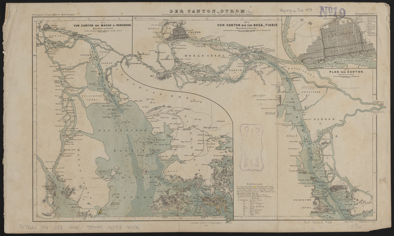
Der Canton-Strom, meistens nach den englischen aufnahmen von 1840-1857
Item Information
- Title:
- Der Canton-Strom, meistens nach den englischen aufnahmen von 1840-1857
- Cartographer:
- Petermann, A. (August), 1822-1878
- Publisher:
- Justus Perthes (Firm : Gotha, Germany)
- Name on Item:
-
gezeichnet von A. Petermann
- Date:
-
1858
- Format:
-
Maps/Atlases
- Location:
-
Boston Public Library
Norman B. Leventhal Map & Education Center - Collection (local):
-
Norman B. Leventhal Map & Education Center Collection
- Subjects:
-
Guangzhou (China)--Maps
Pearl River (China)--Maps
- Places:
-
ChinaCanton (province)Canton
ChinaCanton (province)Zhu Jiang (river)
- Extent:
- 3 maps on 1 sheet ; 25 x 42 cm
- Terms of Use:
-
No known copyright restrictions.
No known restrictions on use.
- Publisher:
-
Gotha :
Perthes
- Scale:
-
Scales differ
- Language:
-
German
- Table of Contents:
-
No. 1. Von Canton bis Macao u. Hongkong
No. 2. Von Canton bis zur Boca-Tigris
No. 3. Plan von Canton.
- Notes:
-
Relief shown by hachures. Depths shown by soundings.
From Petermanns geographische Mittheilungen, band 4.
- Identifier:
-
06_01_015253
- Call #:
-
G7822.P4 1858 .P48
- Barcode:
-
39999085934006