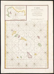
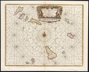
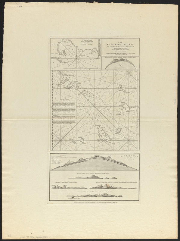
The Cape Verd Islands, laid down from the remarks and observations of experienced navigators
Item Information
- Title:
- The Cape Verd Islands, laid down from the remarks and observations of experienced navigators
- Cartographer:
- Après de Mannevillette, Jean-Baptiste-Nicolas-Denis d', 1707-1780
- Name on Item:
-
by Mons. d'Apres de Mannevillete, with several additions
- Date:
-
1788
- Format:
-
Maps/Atlases
- Location:
-
Boston Public Library
Norman B. Leventhal Map & Education Center - Collection (local):
-
Norman B. Leventhal Map & Education Center Collection
- Subjects:
-
Nautical charts--Cape Verde--Early works to 1800
Cape Verde--Maps--Early works to 1800
Cape Verde--Aerial views--Early works to 1800
- Places:
-
Cape Verde
- Extent:
- 3 maps on 1 sheet ; 26 x 28 cm. or smaller, on sheet 75 x 56 cm.
- Terms of Use:
-
No known copyright restrictions.
No known restrictions on use.
- Publisher:
-
London :
Printed for Robt. Sayer
- Scale:
-
Scale not given
- Language:
-
English
- Notes:
-
Includes inset of Praya Bay, A View of the English Road in the island of Mayo and A View of Praya Bay, in the island of St. Jago.
Relief shown pictorially.
Depth shown by soundings.
- Identifier:
-
06_01_014368
- Call #:
-
G9160 1788 .M36
- Barcode:
-
39999058995620