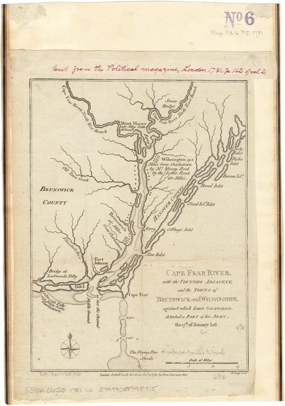
Cape Fear River, with the counties adjacent, and the towns of Brunswick and Wilmington, against which Lord Cornwallis, detached a part of his army, the 17th of January last
This map is also available in American Revolutionary Geographies Online (ARGO), a collections portal especially built for material relating to the American Revolutionary War Era. Visit ARGO to learn more about this item and explore the historical geography of North America in the late eighteenth century.
Item Information
- Title:
- Cape Fear River, with the counties adjacent, and the towns of Brunswick and Wilmington, against which Lord Cornwallis, detached a part of his army, the 17th of January last
- Creator:
- Lodge, John, d. 1796
- Name on Item:
-
Jn. Lodge, sculp.
- Date:
-
1781
- Format:
-
Maps/Atlases
- Location:
-
Boston Public Library
Norman B. Leventhal Map & Education Center - Collection (local):
-
Norman B. Leventhal Map & Education Center Collection
- Subjects:
-
Cape Fear River (N.C.)--History--18th century--Maps--Early works to 1800
- Places:
-
North CarolinaCape Fear (river)
- Extent:
- 1 map ; 24 x 18 cm.
- Terms of Use:
-
No known copyright restrictions.
No known restrictions on use.
- Publisher:
-
London :
J. Bew
- Scale:
-
Scale [ca. 1:410,000].
- Language:
-
English
- Notes:
-
Depths shown by soundings.
- Identifier:
-
06_01_003125
- Call #:
-
G3906.C16S3 1781 .L6
- Barcode:
-
39999058998715


