Toggle navigation
LMEC Home
Exhibitions
Georeferencing
Tools for Teachers
Collections
My Favorites
Sign Up / Log In
Search
Search the map portal
Map Collection
Map Collection
Map Sets
Search
Search
Search for
Search In
All Fields
Creator
Title
Subject
Place
Search All Digital Collections
Advanced Search
13385 Results
Filter your Search
Place
North and Central America
9,353
United States
7,286
Suffolk (county)
1,664
Boston
1,621
Europe
1,035
Canada
949
Massachusetts
875
New York
534
more
Place
»
Topic
Boston (Mass.)--Maps
741
City planning--Massachusetts--Boston--Maps
418
United States--History--Revolution, 1775-1783--Maps
329
United States--Maps
315
Urban renewal--Massachusetts--Boston--Maps
254
Real property--Massachusetts--Boston--Maps
252
Massachusetts--Maps
219
Insurance surveys
197
more
Topic
»
Date
Date range begin
–
Date range end
Current results range from
1482
to
2023
View distribution
Creator
United States. Hydrographic Office
595
Boston Redevelopment Authority
403
Des Barres, Joseph F. W. (Joseph Frederick Wallet), 1722-1824
247
Royal United Services Institute for Defence and Security Studies
160
Jefferys, Thomas, -1771
154
George, III, King of Great Britain, 1738-1820
152
George, IV, King of Great Britain, 1762-1830
151
O.H. Bailey & Co
148
more
Creator
»
Format
Maps/Atlases
13,205
Manuscripts
985
Prints
102
Books
49
Drawings/Illustrations
44
Photographs
15
Objects/Artifacts
13
Documents
7
more
Format
»
Georeferenced
Yes
979
No
12,406
Collection
Norman B. Leventhal Map Center Collection
8,891
American Revolutionary War-Era Maps
3,305
Boston and New England Maps
2,804
Urban Maps
2,397
Maritime Charts and Atlases
1,150
William L. Clements Library Collection
910
Library of Congress Collection
618
Boston Redevelopment Authority Collection
475
more
Collection
»
Available to use
No known restrictions
9,952
Creative Commons license
1,677
Search Constraints
Sort by relevance
relevance
title
date (asc)
date (desc)
Number of results to display per page
20 per page
10
per page
20
per page
50
per page
100
per page
View results as:
grid view
map view
Search Results
6201.
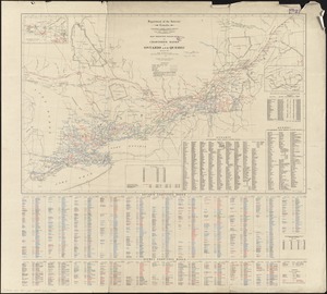
Map of Woods County, West Virginia
6202.
Map of Woodstock, Conn
6203.
Map of Worcester County, Mass
6204.
Map of Worcester County, Massachusetts : based upon the trigonometrical survey of the state
6205.
Map of Worcester County, Massachusetts
6206.
Map of Worcester Mass
6207.
Map of Yakima Region, Washington, Ter.
6208.
A map or draft of a certain tract and parcell of arable and low land of Collo. Henry Beekman being situate & lying within the...
6209.
A map or plot of the twenty-five divisions of land ... late in the Township of Dorchester and now in the Township of Stoughton,...
6210.
A map plat or draught of the twelve divisions of land as they were laid out, bounded & measured to ye proprietors in...
6211.
Map railway route, Seward to Fairbanks : (including Matanuska - branch)
6212.
Map second division railway mail service
6213.
Map seventh division railway mail service
6214.
Map shewing exploratory surveys in the northern portion of the province of British Columbia
6215.
Map shewing the railways of Canada, to accompany annual report on railway statistics 1884
6216.
Map showing anchorage ground in the Port of New York and the Hudson and East Rivers
6217.
Map showing Boston territory tributary to South Metropolitan system and Boston main drainage system
6218.
Map showing branches of chartered banks in Manitoba, Saskatchewan and Alberta
6219.
Map showing branches of chartered banks in Ontario and Quebec
6220.
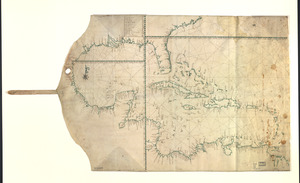
Map showing Caribbean area including West Indies and Gulf of Mexico
‹ Prev
Next ›
1
2
…
307
308
309
310
311
312
313
314
315
…
669
670