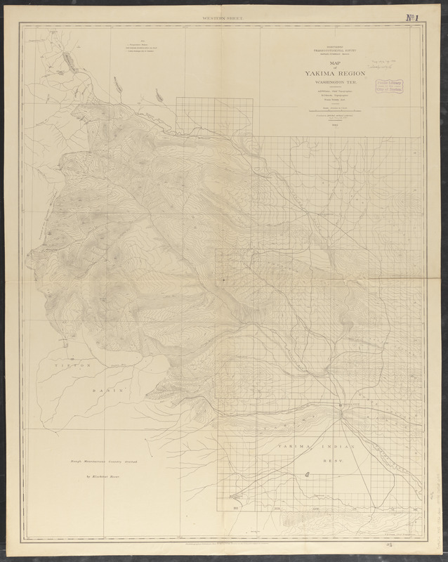
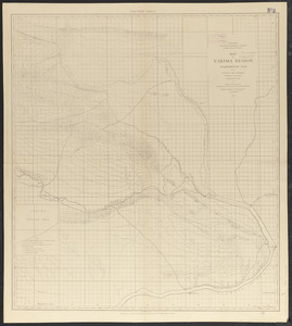
Map of Yakima Region, Washington, Ter.

Item Information
- Title:
- Map of Yakima Region, Washington, Ter.
- Cartographer:
- Goode, Richard Urquhart, 1858-1903
- Cartographer:
- Wilson, A. D. (Allen D.)
- Publisher:
- Northern Transcontinental Survey
- Name on Item:
-
Northern Transcontinental Survey ; A.D. Wilson, Chief Topographer ; R.U. Goode, Topographer
- Date:
-
1882
- Format:
-
Maps/Atlases
- Location:
-
Boston Public Library
Norman B. Leventhal Map & Education Center - Collection (local):
-
Norman B. Leventhal Map & Education Center Collection
- Subjects:
-
Yakima River Valley (Wash.)--Maps
Topographic maps
- Places:
-
WashingtonYakima (river)
- Extent:
- 1 map on 2 sheets ; sheets 112 x 88 cm. and 98 x 88 cm.
- Terms of Use:
-
No known copyright restrictions.
No known restrictions on use.
- Publisher:
-
[United States] :
Northern Transcontinental Survey
- Scale:
-
Scale [ca. 1:126,720]. 1 in. = 2 mi.
- Language:
-
English
- Table of Contents:
-
Eastern sheet
Western sheet.
- Notes:
-
Relief shown by contours and spot heights.
"Photolithographed preliminary sheet for the use of the parties in the field, and subject to revision."
- Identifier:
-
06_01_011508B
06_01_011508A
- Call #:
-
G4282.Y35 1882 .G66
- Barcode:
-
39999065686915


