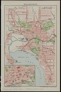
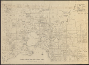
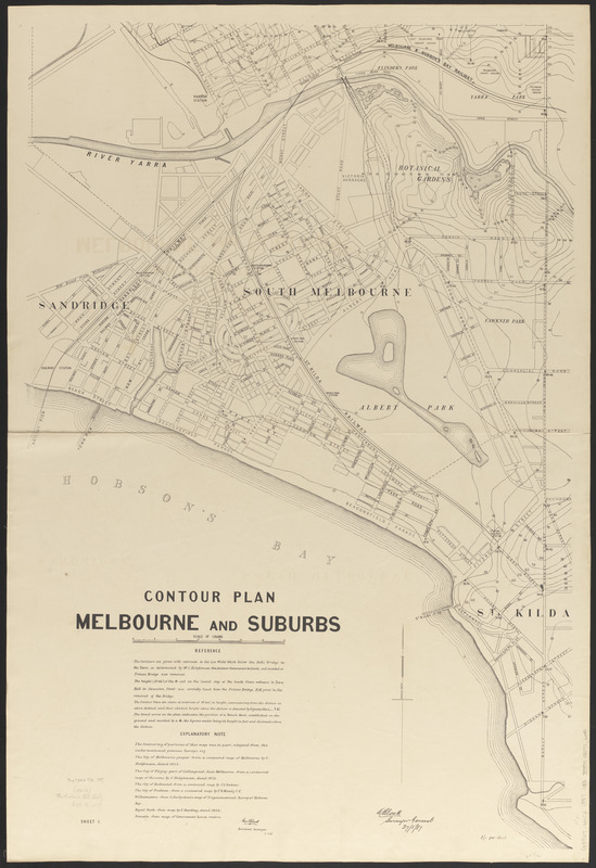
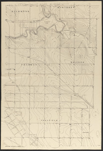
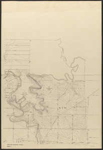
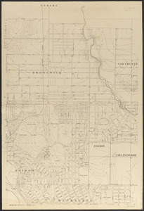
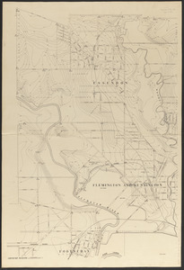
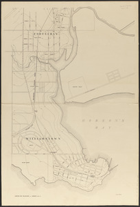
Contour plan, Melbourne and suburbs

Item Information
- Title:
- Contour plan, Melbourne and suburbs
- Cartographer:
- Victoria. Department of Crown Lands and Survey
- Cartographer:
- Black, George
- Cartographer:
- Black, A. (Alexander), 1827-1897
- Name on Item:
-
Geo. Black, Assistant Surveyor, 3.7.85 ; A. Black, Surveyor General, 27.5.87
- Date:
-
1887
- Format:
-
Maps/Atlases
- Location:
-
Boston Public Library
Norman B. Leventhal Map & Education Center - Collection (local):
-
Norman B. Leventhal Map & Education Center Collection
- Subjects:
-
Melbourne (Vic.)--Maps
Topographic maps
- Places:
-
AustraliaVictoriaMelbourne
- Extent:
- 1 map on 6 sheets ; 192 x 191 cm, on sheets 101 x 69 cm
- Terms of Use:
-
No known copyright restrictions.
No known restrictions on use.
- Publisher:
-
[Melbourne] :
[Victoria Department of Crown Lands and Survey]
- Scale:
-
Scale approximately 1:7,920
- Language:
-
English
- Notes:
-
Relief shown by contours and spot heights.
- Identifier:
-
06_01_015404A
06_01_015404B
06_01_015404C
06_01_015404D
06_01_015404E
06_01_015404F
- Call #:
-
G8964.M4C2 1887 .V53
- Barcode:
-
39999085936084