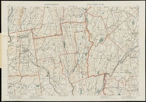
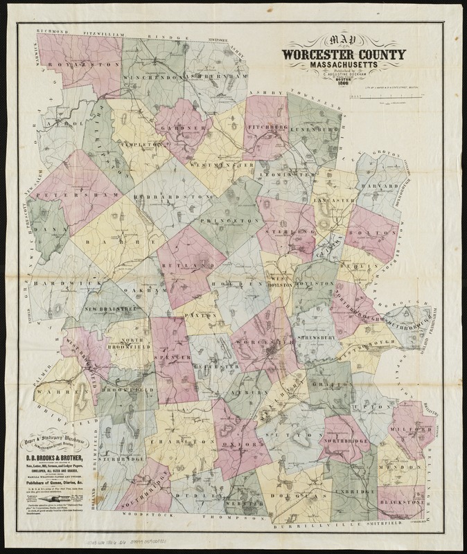
Map of Worcester County, Massachusetts
Item Information
- Title:
- Map of Worcester County, Massachusetts
- Title (alt.):
-
Dockham's pocket maps, Worcester Co., Mass
- Creator:
- Dockham, C. Augustine.
- Date:
-
1866
- Format:
-
Maps/Atlases
- Location:
-
Boston Public Library
Norman B. Leventhal Map & Education Center - Collection (local):
-
Norman B. Leventhal Map & Education Center Collection
- Subjects:
-
Worcester County (Mass.)--Maps
- Places:
-
MassachusettsWorcester (county)
- Extent:
- 1 map : hand col. ; 66 x 55 cm., folded in cover 15 x 10 cm.
- Terms of Use:
-
No known copyright restrictions.
No known restrictions on use.
- Publisher:
-
Boston :
C. Augustine Dockham
- Scale:
-
Scale 1:126,720. 1/2 in. = 1 mile.
- Language:
-
English
- Notes:
-
Relief shown by hachures.
Shows minor civil subdivisions.
Includes advertisement.
- Identifier:
-
06_01_004101
- Call #:
-
G3763.W6 1866 .D6
- Barcode:
-
39999059009801
- LCCN:
-
2005628430