Toggle navigation
LMEC Home
Exhibitions
Georeferencing
Tools for Teachers
Collections
My Favorites
Sign Up / Log In
Search
Search the map portal
Map Collection
Map Collection
Map Sets
Search
Search
Search for
Search In
All Fields
Creator
Title
Subject
Place
Search All Digital Collections
Advanced Search
244 Results
My Search
Start Over
1865
Remove constraint 1865
Filter your Search
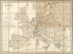
Place
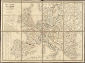
North and Central America
197
United States
145
Virginia
40
Richmond
16
Boston
15
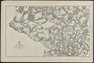
Suffolk (county)
15
Georgia
13
Confederate States of America
11
more
Place
»
Topic
United States--History--Civil War, 1861-1865--Maps
54
Virginia--History--Civil War, 1861-1865--Maps
34
Richmond (Va.)--History--Civil War, 1861-1865--Maps
14
Boston (Mass.)--Maps
10
Confederate States of America--History--Maps
10
Children's maps--Germany
9
United States--History--Civil War, 1861-1865
9
Relief models--Specimens
8
more
Topic
»
Date
Date range begin
–
Date range end
Current results range from
1745
to
1960
View distribution
Creator
Michler, N. (Nathaniel), 1827-1881
15
United States. Army. Corps of Engineers
14
Weyss, J. E.
12
Graham, J. D. (James Duncan), 1799-1865
11
New York Lithographing, Engraving and Printing Co.
11
Strasser, J.
11
Theilkuhl, F.
11
United States Coast Survey
11
more
Creator
»
Format
Maps/Atlases
235
Manuscripts
4
Prints
4
Photographs
3
Books
1
Documents
1
Posters
1
Georeferenced
Yes
24
No
220
Collection
Norman B. Leventhal Map Center Collection
233
Boston and New England Maps
26
Maritime Charts and Atlases
19
Urban Maps
19
David Judkins Weaver Papers
14
Ralph Finos Map Collection at Phillips Academy
4
American Revolutionary War-Era Maps
3
MacLean Collection Map Library
2
more
Collection
»
Available to use
No known restrictions
234
Creative Commons license
4
Search Constraints
Sort by title
relevance
title
date (asc)
date (desc)
Number of results to display per page
50 per page
10
per page
20
per page
50
per page
100
per page
View results as:
grid view
map view
Search Results
1.
The 100th anniversary map of Abraham Lincoln's visit to Massachusetts, September 11-23, 1848
2.
Afrika
3.
Alaska and adjoining territory
4.
America
5.
L'Anse including Portage Entry and part of Keweenaw Bay, Lake Superior
6.
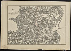
Antietam
7.
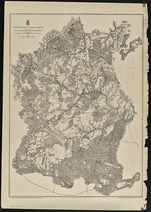
Appomattox Court House
8.
Approaches to Fort Hindman, Arkansas Post, on the Arkansas River : captured by the U.S. Mississippi Squadron, under command of...
9.
Approaches to Fort Hindman, Arkansas Post, on the Arkansas River : captured by the U.S. Mississippi Squadron, under command of...
10.
Archaeological map of Castle Neck and vicinity, Ipswich, Mass. showing ancient Indian villages & remains : made from actual...
11.
Asien
12.
Australien und Polynesien
13.
Azores, Santa Maria and the Formigas
14.
Bacon's Map of the seat of war in Virginia : showing minutely the interesting localities in the vicinity of Richmond
15.
Bacon's map of the vicinity of Richmond, and Peninsular Campaign in Virginia : showing also the interesting localities along...
16.
Bacon's military map of the United States shewing the forts & fortifications
17.
Bacon's new army map of the seat of war in Virginia, showing the battle fields, fortifications, etc., on & near the Potomac River
18.
Bacon's steel plate map of the American states north & south : showing the railways , forts, and fortifications
19.
Bacon's topographical war map showing the battle fields of Pennsylvania, Maryland, and Virginia
20.
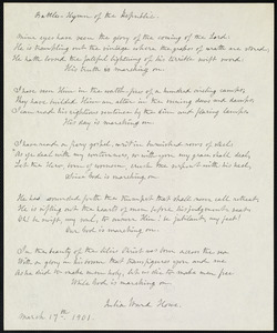
Battle hymn of the republic
21.
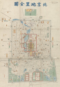
Beijing dili quantu
22.
Bermuda Hundred
23.
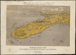
Birds eye view of Florida and part of Georgia and Alabama
24.
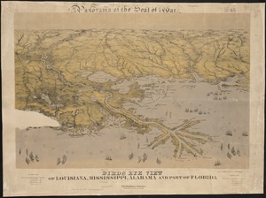
Birds eye view of Louisiana, Mississippi, Alabama and part of Florida
25.
Birds eye view of North and South Carolina and part of Georgia
26.
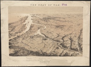
Bird's eye view of part of Maryland, Distr of Columbia and part of Virginia
27.
Birds eye view of the Mississippi Valley from Cairo to the Gulf of Mexico
28.
Birds eye view of Virginia, Maryland, Delaware and the District of Columbia
29.
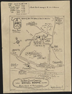
The Boone-Lincoln community where Daniel Boone was born, Berks County, Pennsylvania
30.
Carte itinéraire de l'Europe indiquant les limites actuelles des etats : dediée au Roi
31.
Carte itinéraire de l'Europe indiquant les limites actuelles des etats : dédiée au Roi
32.
Central Virginia showing Lieut. Gen'l. U.S. Grant's Campaign and marches of the armies under his command in 1864-65
33.
Chancellorville
34.
Chart of Boston Harbor and Massachusetts Bay : with map of the adjacent country
35.
Chart of Cape Cod Harbor and the adjacent coast of Provincetown and Truro
36.
Chart of Narraganset Bay : surveyed in 1832
37.
Chart of the Vineyard Sound and Nantucket Shoals
38.
City of Lynn, Mass
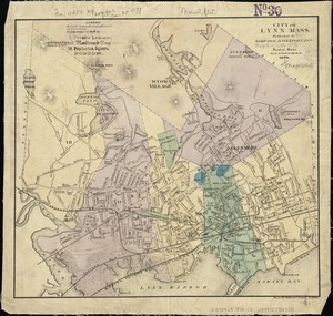
39.
Civil War centennial
40.
Coast of New Jersey between Sandy Hook and Long Branch
41.
Cold Harbor
42.
Colton's map of the oil district of West Virginia and Ohio
43.
Colton's map of the seat of war in Virginia : showing minutely the interesting localities in the vicinity of Richmond
44.
Colton's new railroad & county map of the United States, the Canadas &c
45.
Comparative map of Cape Cod Harbor showing physical changes between the survey of Maj. J.D. Graham in 1835, and the U.S. Coast...
46.
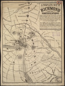
A complete map of Richmond and its fortifications within a circle of 12 miles showing the numerous forts, batteries and the...
47.
The country of So red the rose, by Stark Young, Scribners
48.
The country round Washington : the Chesapeake and the Potomac
49.
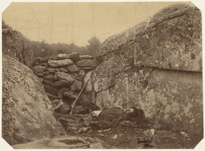
Dead rebel sharpshooter at Gettysburg
50.
Deutschland nebst den königreichen Holland, Belgien und der republik Schweiz
‹ Prev
Next ›
1
2
3
4
5