Toggle navigation
LMEC Home
Exhibitions
Georeferencing
Tools for Teachers
Collections
My Favorites
Sign Up / Log In
Search
Search the map portal
Map Collection
Map Collection
Map Sets
Search
Search
Search for
Search In
All Fields
Creator
Title
Subject
Place
Search All Digital Collections
Advanced Search
200 Results
My Search
Start Over
1877
Remove constraint 1877
Filter your Search
Place
North and Central America
94
United States
72
Oceania
37
Massachusetts
29
Europe
27
South America
23
Asia
15
Chile
14
more
Place
»
Topic
United States Exploring Expedition (1838-1842)
16
Canada--Boundaries--United States--Maps
13
United States--Boundaries--Canada--Maps
13
United States--History--War of 1812--Territorial questions--Maps
13
Balkan Peninsula--Maps
7
Tuamotu Archipelago (French Polynesia)--Maps
7
Turkey--Maps
7
Coasts--Chile--Maps
4
more
Topic
»
Date
Date range begin
–
Date range end
Current results range from
1755
to
1952
View distribution
Creator
United States. Hydrographic Office
42
Wilkes, Charles, 1798-1877
38
United States Exploring Expedition (1838-1842)
35
Sherman & Smith
21
Barclay, Anthony, 1792-1877
13
Porter, Peter B. (Peter Buell), 1773-1844
13
United States. Light-House Board
13
Thompson, David, 1770-1857
11
more
Creator
»
Format
Maps/Atlases
199
Manuscripts
1
Photographs
1
Georeferenced
Yes
10
No
190
Collection
Norman B. Leventhal Map & Education Center Collection
189
Maritime Charts and Atlases
81
Urban Maps
44
Boston and New England Maps
42
American Antiquarian Society Collection
4
American Revolutionary War-Era Maps
4
Town plans, 1830
4
American Textile History Museum Image Collection
2
more
Collection
»
Available to use
No known restrictions
190
Creative Commons license
2
Search Constraints
Sort by relevance
relevance
title
date (asc)
date (desc)
Number of results to display per page
20 per page
10
per page
20
per page
50
per page
100
per page
View results as:
grid view
map view
Search Results
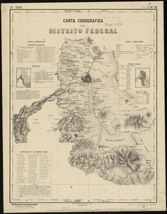
141.
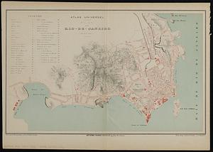
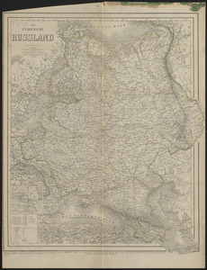
Plan de Rio-de-Janeiro (Bresil)
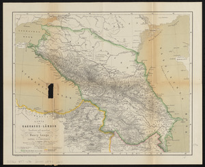
142.
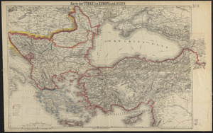
Chart of Narraganset Bay : surveyed in 1832
143.
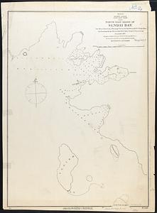
Pacific Ocean, Japan, east coast, north east shore of Sendai Bay
144.
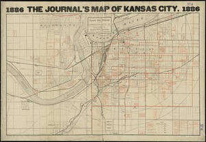
Kansas City, Missouri and its surroundings
145.
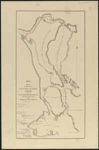
Map of the river Sainte Mary surveyed by order of the honorable the Commissioners under the 6th and 7th articles of the Treaty...
146.
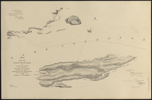
No. 3 Map of Isle Royale in Lake Superior with the adjacent shores and islands surveyed by order of the honorable the...
147.
1879. Progress map of the U.S. Geographical Surveys west of the 100th Meridian : prepared under the direction of 1st Lieut....
148.
Maps with a moral
149.
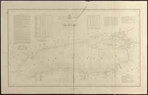
Lake Ontario
150.
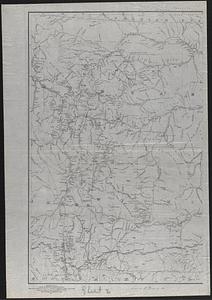
Map of the Yellowstone and Missouri Rivers and their tributaries : explored by Capt. W.F. Raynolds, Topl. Engrs., and 1st...
151.
South Pacific Ocean, Paumotu Group - Rairoa (Rangiroa) Island, Avatoru Pass and anchorage
152.
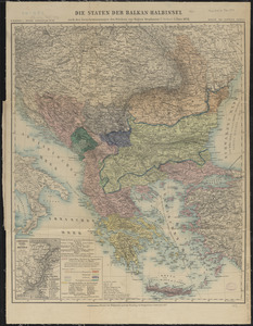
Die staten der Balkan-Halbinsel : nach den Grenzbestimmungen des Friedens von Haġios Stephanos (S. Stefano) 3. März 1878
153.
Boston Bay and approaches
154.
From Muskeget Channel to Buzzard's Bay and entrance to Vineyard Sound, Mass
155.
Asiatische Türkei
156.
Carta corografica del Distrito Federal
157.
Das Europäische Russland
158.
Karte der Kaukasus-Länder
159.
Karte der Türkei in Europa und Asien
160.
Kaukasien
‹ Prev
Next ›
1
2
…
4
5
6
7
8
9
10