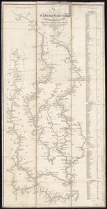
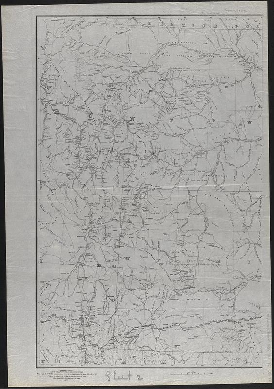
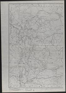
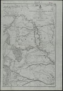
Map of the Yellowstone and Missouri Rivers and their tributaries : explored by Capt. W.F. Raynolds, Topl. Engrs., and 1st Lieut. H.E. Maynadier, 10th Infy. Assistant, 1859-60
Item Information
- Title:
- Map of the Yellowstone and Missouri Rivers and their tributaries : explored by Capt. W.F. Raynolds, Topl. Engrs., and 1st Lieut. H.E. Maynadier, 10th Infy. Assistant, 1859-60
- Engraver:
- United States. Army. Office of the Chief of Engineers
- Cartographer:
- Gillespie, G. L.
- Name on Item:
-
revised and enlarged by Major G.L. Gillespie, U.S. Engr's., Bvt. Lt. Col., U.S.A., Chief Engr., Military Division of the Missouri, 1876 ; engraved in the Office of the Chief of Engineers
- Date:
-
1877
- Format:
-
Maps/Atlases
- Location:
-
Boston Public Library
Norman B. Leventhal Map & Education Center - Collection (local):
-
Norman B. Leventhal Map & Education Center Collection
- Subjects:
-
Yellowstone River--Maps
Missouri River--Maps
- Places:
-
Yellowstone River
Missouri River
- Extent:
- 1 map on 2 sheets ; 79 x 101 cm, on sheets 87 x 61 cm
- Terms of Use:
-
No known copyright restrictions.
No known restrictions on use.
- Publisher:
-
[Washington, D.C.] :
Office of the Chief of Engineers
- Scale:
-
Scale 1:1,200,000
- Language:
-
English
- Notes:
-
Relief shown by hachures.
In lower left margin: "Western sheet. Map of Yellowstone and Missouri Rivers. From Capt. Raynolds exploration 1859-60, with additions by Major Gillespie. Published by authority of the Hon. the Secretary of War, Office of the Chief of Engineers, U.S. Army. 1877."
- Notes (citation):
-
LC Civil War Maps (2nd ed.), S199
- Identifier:
-
06_01_008793B
06_01_008793
- Call #:
-
G4127.Y4 1877 .U55
- Barcode:
-
39999065657916