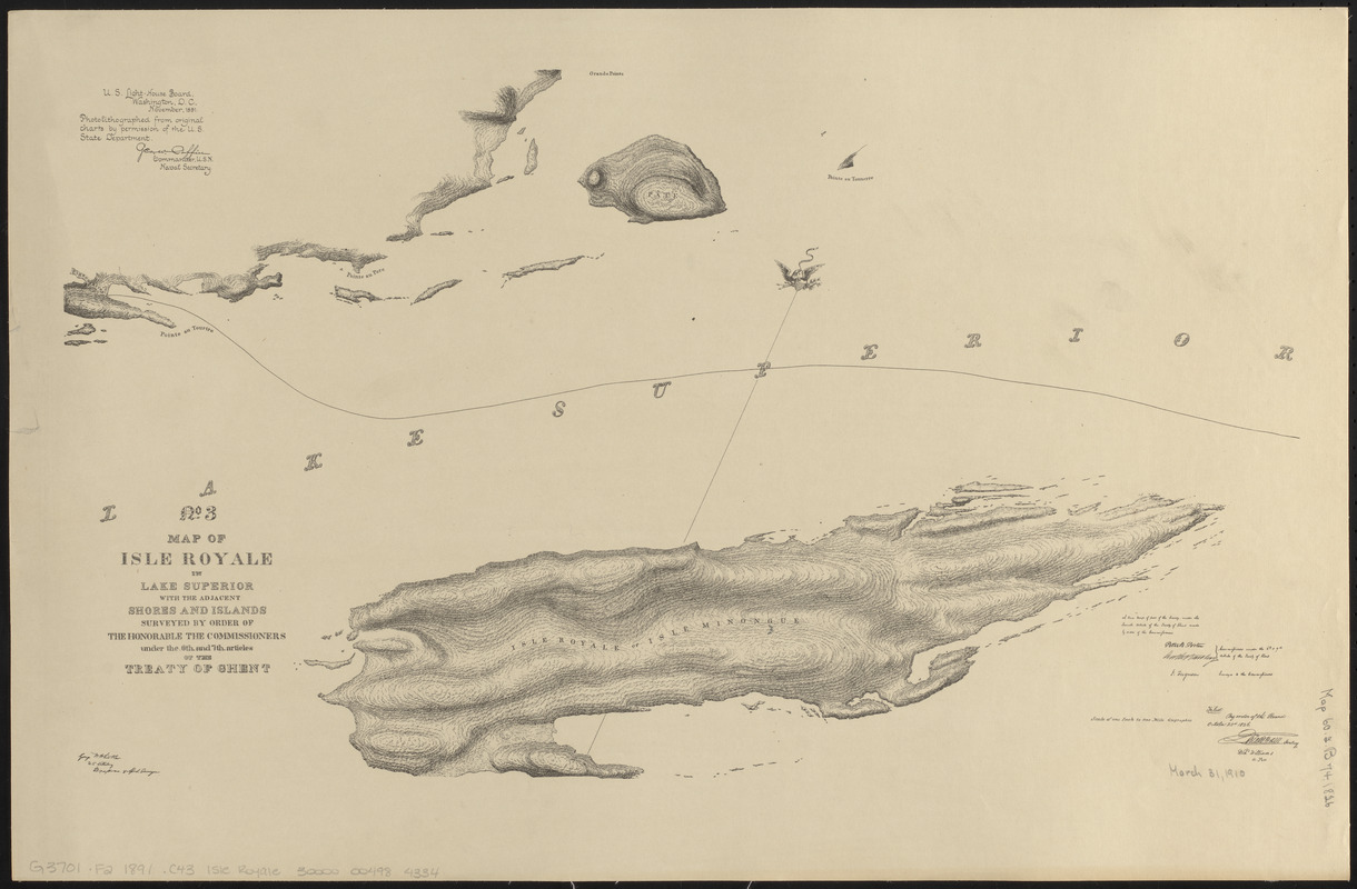
No. 3 Map of Isle Royale in Lake Superior with the adjacent shores and islands surveyed by order of the honorable the Commissioners under the 6th and 7th articles of the Treaty of Ghent
Item Information
- Title:
- No. 3 Map of Isle Royale in Lake Superior with the adjacent shores and islands surveyed by order of the honorable the Commissioners under the 6th and 7th articles of the Treaty of Ghent
- Title (alt.):
-
Map of Isle Royale in Lake Superior with the adjacent shores and islands
- Title (uniform):
-
Charts for the international boundary between the United States and the Dominion of Canada
- Contributor:
- Barclay, Anthony, 1792-1877
- Contributor:
- Porter, Peter B. (Peter Buell), 1773-1844
- Surveyor:
- Ferguson, J.
- Draftsman:
- Whistler, George W. (George Washington), 1800-1849
- Surveyor:
- Whistler, George W. (George Washington), 1800-1849
- Publisher:
- United States. Light-House Board
- Name on Item:
-
Peter B. Porter, Anthony Barclay, commissioners under the 6th & 7th articles of the Treaty of Ghent ; I. Ferguson, surveyor to the commissioners ; George W. Whistler, U.S. Artillery, draftsman & asst surveyor
- Date:
-
1891
- Format:
-
Maps/Atlases
- Location:
-
Boston Public Library
Norman B. Leventhal Map & Education Center - Collection (local):
-
Norman B. Leventhal Map & Education Center Collection
- Subjects:
-
Canada--Boundaries--United States--Maps
Isle Royale (Mich.)--Maps
United States--Boundaries--Canada--Maps
United States--History--War of 1812--Territorial questions--Maps
- Places:
-
MichiganKeweenaw (county)Royale, Isle (island)
- Extent:
- 1 map ; 40 x 61 cm
- Terms of Use:
-
No known copyright restrictions.
No known restrictions on use.
- Publisher:
-
Washington D.C. :
U.S. Light-House Board
- Scale:
-
Scale approximately 1:180,000
- Language:
-
English
- Notes:
-
Relief shown by hachures.
Oriented with north towards the upper right.
"A true map of part of the survey, under the seventh article of the Treaty of Ghent made by order of the commissioners."
"Filed by order of the Board October 23d 1826."
"Photolithographed from original charts by permission of the U.S. State Department."
Part of a set of maps [Charts for the international boundary between the United States and the Dominion of Canada].
- Identifier:
-
06_01_008611
- Call #:
-
G3701.F2 1891 .C43 Isle Royale
- Barcode:
-
30000004984334