Toggle navigation
LMEC Home
Exhibitions
Georeferencing
Tools for Teachers
Collections
My Favorites
Sign Up / Log In
Search
Search the map portal
Map Collection
Map Collection
Map Sets
Search
Search
Search for
Search In
All Fields
Creator
Title
Subject
Place
Search All Digital Collections
Advanced Search
1084 Results
My Search
Start Over
Back Bay Boston
Remove constraint Back Bay Boston
Filter your Search
Place
North and Central America
833
United States
531
Massachusetts
238
Suffolk (county)
179
Boston
173
Canada
115
South America
62
Asia
61
more
Place
»
Topic
Boston (Mass.)--Maps
60
City planning--Massachusetts--Boston--Maps
48
Back Bay (Boston, Mass.)--Maps
47
North America--Maps--Early works to 1800
35
Landowners--Massachusetts--Boston--Maps
26
Real property--Massachusetts--Boston--Maps
26
New England--Maps--Early works to 1800
24
Nova Scotia--Maps--Early works to 1800
24
more
Topic
»
Date
Date range begin
–
Date range end
Current results range from
1565
to
2020
View distribution
Creator
United States. Hydrographic Office
277
Des Barres, Joseph F. W. (Joseph Frederick Wallet), 1722-1824
64
Boston Redevelopment Authority
36
Jefferys, Thomas, -1771
24
Sayer, Robert, 1725-1794
24
Franke, M. (Max)
23
U.S. Lake Survey
22
United States Exploring Expedition (1838-1842)
21
more
Creator
»
Format
Maps/Atlases
1,069
Manuscripts
69
Drawings/Illustrations
10
Objects/Artifacts
3
Prints
3
Books
1
Posters
1
Georeferenced
Yes
54
No
1,030
Collection
Norman B. Leventhal Map & Education Center Collection
945
Maritime Charts and Atlases
481
Boston and New England Maps
265
American Revolutionary War-Era Maps
231
Urban Maps
138
Boston Redevelopment Authority Collection
54
Mapping Boston Collection
40
Library of Congress Collection
35
more
Collection
»
Available to use
No known restrictions
946
Creative Commons license
112
Search Constraints
Sort by relevance
relevance
title
date (asc)
date (desc)
Number of results to display per page
20 per page
10
per page
20
per page
50
per page
100
per page
View results as:
grid view
map view
Search Results
101.
Bay of Chaleurs
102.
A plan of the bay and harbor of Boston : surveyed agreeably to the orders and instructions of the Right Honorable the Lords...
103.
Massachusetts Bay Transportation Authority
104.
Chart of Narraganset Bay : surveyed in 1832
105.
Red Sea, Suez Bay : from British surveys in 1870, corrected to 1872
106.
Cape Cod Bay, Massachusetts
107.
Chart of Sandusky Bay
108.
Chart of Plymouth Bay
109.
Chart of Plymouth Bay
110.
Chart of Plymouth Bay
111.
Thunder Bay, Lake Huron
112.
[Chignecto Bay and vicinity]
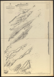
113.
[Bay of Seven Islands]
114.
Sandwich Bay ... low water
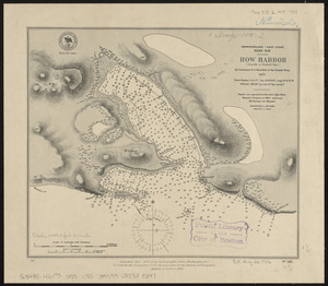
115.
Newfoundland - east coast, Hare Bay, How Harbor (Outarde or Bustard Bay)
116.
Coast of Maine showing Blue Hill Bay, Penobscot Bay, Belfast Bay, Islesboro Island, Deer Island, and other islands
117.
Coast of Maine showing Blue Hill Bay, Penobscot Bay, Belfast Bay, Islesboro Island, Deer Island, and other islands
118.
A chart of Massachusetts Bay
119.
Newfoundland--east coast, Conception Bay, Carbonear to Brigus Bay including Harbor Grace : from a Brit. survey in 1866,...
120.
West Island and vicinity, Buzzard's Bay, Mass. : surveyed in 1845 ; copied from the original in archives of the U.S. Coast and...
‹ Prev
Next ›
1
2
3
4
5
6
7
8
9
10
…
54
55


![[Chignecto Bay and vicinity]](https://bpldcassets.blob.core.windows.net/derivatives/images/commonwealth:9g54xk66m/image_thumbnail_300.jpg)
![[Bay of Seven Islands]](https://bpldcassets.blob.core.windows.net/derivatives/images/commonwealth:7h149v48t/image_thumbnail_300.jpg)