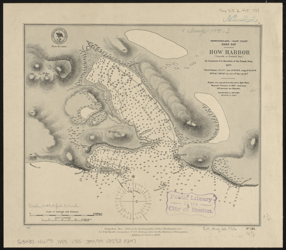
Newfoundland - east coast, Hare Bay, How Harbor (Outarde or Bustard Bay)
Item Information
- Title:
- Newfoundland - east coast, Hare Bay, How Harbor (Outarde or Bustard Bay)
- Title (alt.):
-
How Harbor (Outarde or Bustard Bay)
- Issuing body:
- United States. Hydrographic Office
- Surveyor:
- Maréchal, F. A.
- Name on Item:
-
by Lieutenant F.A. Maréchal, of the French navy, 1877
- Date:
-
1888
- Format:
-
Maps/Atlases
- Location:
-
Boston Public Library
Norman B. Leventhal Map & Education Center - Collection (local):
-
Norman B. Leventhal Map & Education Center Collection
- Subjects:
-
Nautical charts--Newfoundland and Labrador--Howe Harbour
Howe Harbour (N.L.)--Maps
- Places:
-
CanadaNewfoundland and Labrador (province)
Howe Harbour
- Extent:
- 1 map ; 23 x 27 cm
- Terms of Use:
-
No known copyright restrictions.
No known restrictions on use.
- Publisher:
-
Washington, D.C. :
Hydrographic Office
- Edition:
- Edition of October 1888
- Scale:
-
Scale approximately 1:26,000
- Language:
-
English
- Notes:
-
Relief shown by hachures and spot heights. Depths shown by soundings and isolines.
- Identifier:
-
06_01_015552
- Call #:
-
G9096.P5 svar .U55
- Barcode:
-
39999085938247


