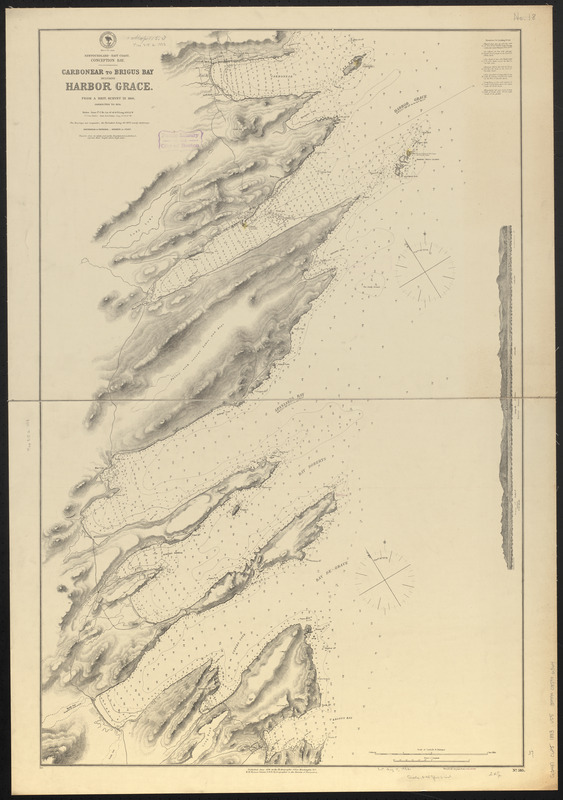
Newfoundland--east coast, Conception Bay, Carbonear to Brigus Bay including Harbor Grace : from a Brit. survey in 1866, corrected to 1874
Item Information
- Title:
- Newfoundland--east coast, Conception Bay, Carbonear to Brigus Bay including Harbor Grace : from a Brit. survey in 1866, corrected to 1874
- Title (alt.):
-
Carbonear to Brigus Bay including Harbor Grace
- Issuing body:
- United States. Hydrographic Office
- Date:
-
1883
- Format:
-
Maps/Atlases
- Location:
-
Boston Public Library
Norman B. Leventhal Map & Education Center - Collection (local):
-
Norman B. Leventhal Map & Education Center Collection
- Subjects:
-
Coasts--Newfoundland and Labrador--Maps
Nautical charts--Newfoundland and Labrador--Carbonear Bay
Nautical charts--Newfoundland and Labrador--Harbour Grace (Harbor)
Nautical charts--Newfoundland and Labrador--Spaniard's Bay
Nautical charts--Newfoundland and Labrador--Bay Roberts
Nautical charts--Newfoundland and Labrador--Bay de Grave
Carbonear Bay (N.L.)--Maps
Harbour Grace (N.L. : Harbor)--Maps
Spaniard's Bay (N.L.)--Maps
Bay Roberts (N.L.)--Maps
Bay de Grave (N.L.)--Maps
- Places:
-
CanadaNewfoundland and Labrador (province)Carbonear
CanadaNewfoundland and Labrador (province)Harbour Grace
CanadaNewfoundland and Labrador (province)Spaniards Bay
CanadaNewfoundland and Labrador (province)Bay Roberts
- Extent:
- 1 map ; 95 x 62 cm
- Terms of Use:
-
No known copyright restrictions.
No known restrictions on use.
- Publisher:
-
Washington, D.C. :
Hydrographic Office
- Scale:
-
Scale approximately 1:25,500
- Language:
-
English
- Notes:
-
Relief shown by hachures and spot heights. Depths shown by soundings and isolines.
Includes sailing directions and view of Harbor Grace.
"Cor. (32.III.78)(42.V.81)(203.XII'83.)
- Identifier:
-
06_01_016380 2
- Call #:
-
G9096.P5 svar .U55
- Barcode:
-
39999085946364


