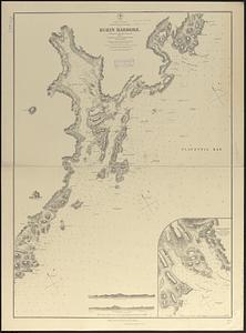
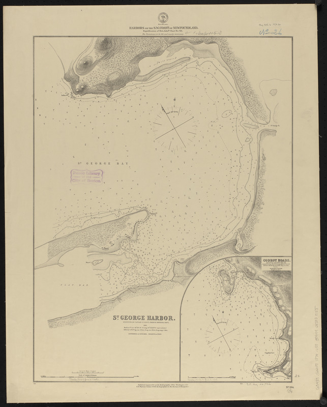
Harbors on the s.w. coast of Newfoundland : republication of Brit. Admty. chart no. 743
Item Information
- Title:
- Harbors on the s.w. coast of Newfoundland : republication of Brit. Admty. chart no. 743
- Title (alt.):
-
St. George Harbor
Codroy Roads
- Issuing body:
- United States. Hydrographic Office
- Surveyor:
- Cloué, Georges-Charles, 1817-1889
- Surveyor:
- Orlebar, J., 1810-1891
- Date:
-
1874
- Format:
-
Maps/Atlases
- Location:
-
Boston Public Library
Norman B. Leventhal Map & Education Center - Collection (local):
-
Norman B. Leventhal Map & Education Center Collection
- Subjects:
-
Coasts--Newfoundland and Labrador--Maps
Nautical charts--Newfoundland and Labrador--Codroy Road
Nautical charts--Newfoundland and Labrador--St. George's Harbour
Codroy Road (N.L.)--Maps
St. George's Harbour (N.L.)--Maps
- Places:
-
CanadaNewfoundland and Labrador (province)Codroy
St. George's Harbour
- Extent:
- 2 maps on 1 sheet ; 61 x 46 cm
- Terms of Use:
-
No known copyright restrictions.
No known restrictions on use.
- Publisher:
-
Washington, D.C. :
Hydrographic Office
- Scale:
-
Scale approximately 1:22,500
Scale approximately 1:24,700
- Language:
-
English
- Table of Contents:
-
St. George Harbor
Codroy Roads.
- Notes:
-
Relief shown hachures and spot heights. Depths shown by soundings and form lines.
- Identifier:
-
06_01_015571
- Call #:
-
G9096.P5 svar .U55
- Barcode:
-
39999085938155