Toggle navigation
LMEC Home
Exhibitions
Georeferencing
Tools for Teachers
Collections
My Favorites
Sign Up / Log In
Search
Search the map portal
Map Collection
Map Collection
Map Sets
Search
Search
Search for
Search In
All Fields
Creator
Title
Subject
Place
Search All Digital Collections
Advanced Search
13385 Results
Filter your Search
Place
North and Central America
10,111
United States
8,249
Massachusetts
2,691
Suffolk (county)
1,664
Boston
1,621
Europe
1,386
Canada
949
New York
640
more
Place
»
Topic
Boston (Mass.)--Maps
741
City planning--Massachusetts--Boston--Maps
418
United States--History--Revolution, 1775-1783--Maps
329
United States--Maps
315
Urban renewal--Massachusetts--Boston--Maps
254
Real property--Massachusetts--Boston--Maps
252
Massachusetts--Maps
219
Insurance surveys
197
more
Topic
»
Date
Date range begin
–
Date range end
Current results range from
1482
to
2023
View distribution
Creator
United States. Hydrographic Office
595
Boston Redevelopment Authority
403
Des Barres, Joseph F. W. (Joseph Frederick Wallet), 1722-1824
247
Royal United Services Institute for Defence and Security Studies
160
Jefferys, Thomas, -1771
154
George, III, King of Great Britain, 1738-1820
152
George, IV, King of Great Britain, 1762-1830
151
O.H. Bailey & Co
148
more
Creator
»
Format
Maps/Atlases
13,205
Manuscripts
985
Prints
102
Books
49
Drawings/Illustrations
44
Photographs
15
Objects/Artifacts
13
Documents
7
more
Format
»
Georeferenced
Yes
979
No
12,406
Collection
Norman B. Leventhal Map & Education Center Collection
8,891
American Revolutionary War-Era Maps
3,305
Boston and New England Maps
2,804
Urban Maps
2,397
Maritime Charts and Atlases
1,150
William L. Clements Library Collection
910
Library of Congress Collection
618
Boston Redevelopment Authority Collection
475
more
Collection
»
Available to use
No known restrictions
9,952
Creative Commons license
1,677
Search Constraints
Sort by relevance
relevance
title
date (asc)
date (desc)
Number of results to display per page
20 per page
10
per page
20
per page
50
per page
100
per page
View results as:
grid view
map view
Search Results
11281.
The Scrimshaw historical map of Cape Cod
11282.
S.e. coast of Nova Scotia : from the most recent British surveys
11283.
The s.e. coast of the United States and its relation to the British West India colonies
11284.
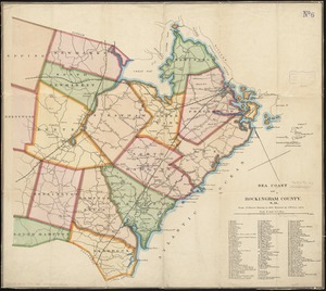
Sea coast of Rockingham County, N.H
11285.
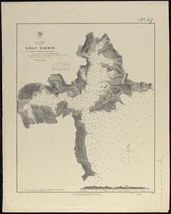
Sea of Japan, Oki Island, Saigo Harbor : from a Japanese government survey in 1879
11286.
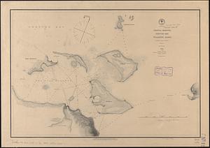
Sea of Japan, west coast of Yezo, dangers off the south point of Okosiri Island : from an examination by the officers of the...
11287.
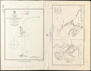
Seagull Harbour, Gretton Bay, Wollaston Island, Tierra del Fuego
11288.
Seagull Harbour, Gretton Bay, Wollaston Island, Tierra del Fuego
11289.
Sears Park conceptual site plan with historic waterway
11290.
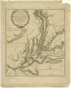
The seat of action, between the British and American forces : or an authentic plan of the western part of Long Island, with the...
11291.
The seat of action, between the British and American forces : or an authentic plan of the western part of Long Island, with the...
11292.
The seat of action between the British and American forces or an authentic plan of Staten Island with the neighbouring...
11293.
The seat of action, between the British and American forces or an authentic plan of the western part of Long Island, with the...
11294.
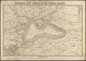
Seat of the Russo-Turkish War
11295.
The seat of war
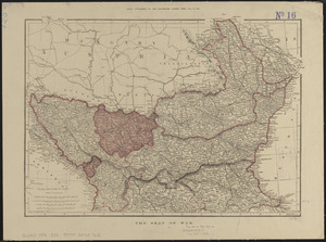
11296.
The seat of war : birds eye view of Virginia, Maryland, Delaware, and the District of Columbia
11297.
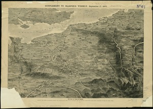
The seat of war in France, showing the scene of M'Mahon's defeat and capitulation, Paris and its environs, and its railroad...
11298.
The Seat of war, in New England
11299.
The seat of war, in New England, by an American volunteer : with the marches of the several corps sent by the colonies, towards...
11300.
The seat of war in New England, by an American volunteer : with the marches of the several corps sent by the Colonies towards...
‹ Prev
Next ›
1
2
…
561
562
563
564
565
566
567
568
569
…
669
670