Toggle navigation
LMEC Home
Exhibitions
Georeferencing
Tools for Teachers
Collections
My Favorites
Sign Up / Log In
Search
Search the map portal
Map Collection
Map Collection
Map Sets
Search
Search
Search for
Search In
All Fields
Creator
Title
Subject
Place
Search All Digital Collections
Advanced Search
3980 Results
My Search
Start Over
massachusetts
Remove constraint massachusetts
Filter your Search
Place
North and Central America
3,932
United States
3,886
Massachusetts
2,798
Suffolk (county)
1,632
Boston
1,601
Middlesex (county)
381
Worcester (county)
244
Essex (county)
223
more
Place
»
Topic
Boston (Mass.)--Maps
741
City planning--Massachusetts--Boston--Maps
418
Real property--Massachusetts--Boston--Maps
254
Urban renewal--Massachusetts--Boston--Maps
254
Massachusetts--Maps
233
Landowners--Massachusetts--Boston--Maps
170
Buildings--Massachusetts--Boston--Maps
126
Land use--Massachusetts--Boston--Maps
102
more
Topic
»
Date
Date range begin
–
Date range end
Current results range from
1625
to
2023
View distribution
Creator
Boston Redevelopment Authority
404
Bromley, George Washington
98
Bromley, Walter Scott
96
MassGIS (Office : Mass.)
76
G.W. Bromley & Co.
75
Geo. H. Walker & Co.
72
Walling, Henry Francis, 1825-1888
65
Applied Geographics, Inc.
58
more
Creator
»
Format
Maps/Atlases
3,929
Manuscripts
161
Books
34
Drawings/Illustrations
25
Prints
15
Photographs
12
Objects/Artifacts
3
Ephemera
2
more
Format
»
Georeferenced
Yes
309
No
3,671
Collection
Norman B. Leventhal Map & Education Center Collection
2,463
Boston and New England Maps
2,443
Urban Maps
1,759
Boston Redevelopment Authority Collection
474
Town plans, 1794
403
Town plans, 1830
324
American Revolutionary War-Era Maps
288
Massachusetts Real Estate Atlases
144
more
Collection
»
Available to use
No known restrictions
3,505
Creative Commons license
229
Search Constraints
Sort by relevance
relevance
title
date (asc)
date (desc)
Number of results to display per page
20 per page
10
per page
20
per page
50
per page
100
per page
View results as:
grid view
map view
Search Results
61.
Wakefield, Massachusetts
62.
Wakefield, Massachusetts
63.
Wakefield, Massachusetts
64.
Wakefield, Massachusetts
65.
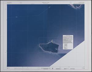
Wakefield [Massachusetts]
66.
Wakefield, Massachusetts
67.
Massachusetts Turnpike map : the main street of Massachusetts
68.
Hingham/Hull Massachusetts : Massachusetts CZM shoreline change analysis project
69.
Map of Massachusetts : to accompany the Massachusetts register & business directory
70.
Map of Massachusetts
71.
Marthas Vineyard, Massachusetts : landuse in 1985
72.
Map of Massachusetts : state Senate legislative districts : (Chapter 305 of the Acts of 1987)
73.
Massachusetts coastal watersheds
74.
Massachusetts river basins
75.
Massachusetts tourists map : showing tourways, picnic sites, beaches, and camp grounds
76.
Nomans Land Massachusetts : [coastal high hazard area mapping project]
77.
Winthrop/Boston Massachusetts : [coastal high hazard area base map]
78.
Massachusetts river basins
79.
Massachusetts coastal towns
80.
Boston Harbor, Massachusetts
‹ Prev
Next ›
1
2
3
4
5
6
7
8
…
198
199
![Wakefield [Massachusetts]](https://bpldcassets.blob.core.windows.net/derivatives/images/commonwealth:c534g404x/image_thumbnail_300.jpg)