Massachusetts coastal watersheds
Item Information
- Title:
- Massachusetts coastal watersheds
- Sponsor:
- Massachusetts Coastal Zone Management Office
- Sponsor:
- Massachusetts Bays Program
- Contributor:
- MassGIS (Office : Mass.)
- Funder:
- United States. National Oceanic and Atmospheric Administration
- Funder:
- United States. Environmental Protection Agency
- Name on Item:
-
Map sponsored by the Massachusetts Coastal Zone Management Office and the Massachusetts Bays Program
- Date:
-
[1994]
- Format:
-
Maps/Atlases
- Location:
-
Boston Public Library
Norman B. Leventhal Map & Education Center - Collection (local):
-
Applied Geographics, Inc. Records
- Subjects:
-
Massachusetts--Maps
Coastal zone management--Massachusetts--Maps
Marine resources conservation--Massachusetts--Maps
Watersheds--Massachusetts--Maps
- Places:
-
Massachusetts
- Extent:
- 1 map : color ; 53 x 68 cm, on sheet 69 x 84 cm
- Terms of Use:
-
No known copyright restrictions.
No known restrictions on use.
- Publisher:
-
[Boston, Massachusetts] :
[Massachusetts Coastal Zone Management Office] ; [Massachusetts Bays Program]
- Scale:
-
Scale not given
- Language:
-
English
- Notes:
-
"The maps shown on this poster were produced using digital data from the Massachusetts Executive Office of Environmental Affairs' Geographic Information System -- MassGIS ..."
"Funding provided by grants from the National Oceanic and Atmospheric Administration and the United States Environmental Protection Agency."
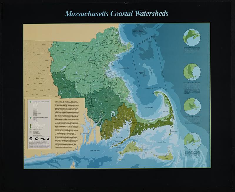
Includes: Gulf of Maine Watershed, Massachusetts Bays Watershed, Narragansett Bay Watershed, Buzzards Bay Watershed.
Depths shown by gradient tints.
- Notes (date):
-
This date is inferred.
- Identifier:
-
06_01_019112
- Call #:
-
AppGeo Folder 36 no.8


