Toggle navigation
LMEC Home
Exhibitions
Georeferencing
Tools for Teachers
Collections
My Favorites
Sign Up / Log In
Search
Search the map portal
Map Collection
Map Collection
Map Sets
Search
Search
Search for
Search In
All Fields
Creator
Title
Subject
Place
Search All Digital Collections
Advanced Search
113 Results
My Search
Start Over
g3300
Remove constraint g3300
Filter your Search
Place
North and Central America
112
North America
100
United States
27
Canada
18
Northeastern United States
3
West Indies
3
Atlantic Ocean
2
California
2
more
Place
»
Topic
North America--Maps--Early works to 1800
79
North America--Maps
19
Canada--Maps--Early works to 1800
9
United States--Maps--Early works to 1800
7
Canada--Maps
5
Great Britain--Colonies--America--Maps--Early works to 1800
5
United States--Maps
4
British--America--Maps--Early works to 1800
3
more
Topic
»
Date
Date range begin
–
Date range end
Current results range from
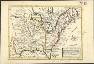
1548
to
1973
View distribution
Creator
Mitchell, John, 1711-1768
6
Moll, Herman, d. 1732
6
Anville, Jean Baptiste Bourguignon d', 1697-1782
5
Kitchin, Thomas, d. 1784
3
L'Isle, Guillaume de, 1675-1726
3
Popple, Henry, d. 1743
3
Sanson, Nicolas, 1600-1667
3
Arrowsmith, Aaron, 1750-1823
2
more
Creator
»
Format
Maps/Atlases
113
Manuscripts
2
Georeferenced
Yes
4
No
109
Collection
Norman B. Leventhal Map & Education Center Collection
113
American Revolutionary War-Era Maps
59
Boston and New England Maps
1
Available to use
No known restrictions
112
Search Constraints
Sort by relevance
relevance
title
date (asc)
date (desc)
Number of results to display per page
20 per page
10
per page
20
per page
50
per page
100
per page
View results as:
grid view
map view
Search Results
61.
Map of the provinces of upper & lower Canada with the adjacent parts of the United States of America, &c
62.
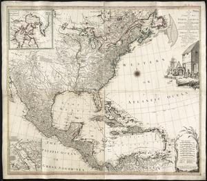
Map of the United States of America, the British provinces, Mexico, the West Indies and Central America, with part of New...
63.
Map of the United States of America, the British Provinces, Mexico, the West Indies and Central America, with part of New...
64.
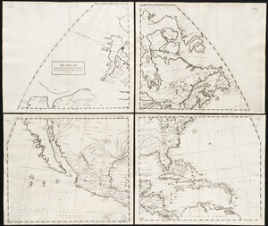
Mexicum in hac forma in lucem
65.
A new and accurate map of the present seat of war in North America
66.
A new and correct map of North America, with the West India Islands : divided according to the last Treaty of Peace, concluded...
67.
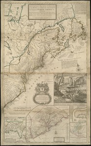
A New and correct map of the British colonies in North America comprehending eastern Canada with the province of Quebec, New...
68.
A new and exact map of the dominions of the King of Great Britain on ye continent of North America : containing Newfoundland,...
69.
A new map of North America : with the British, French, Spanish, Dutch & Danish dominions on that great continent, and the West...
70.
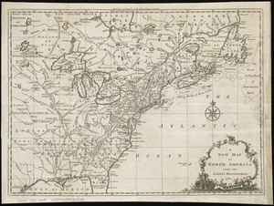
A new map of North America
71.
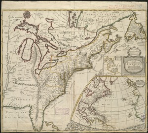
A new map of North America from the latest discoveries
72.
A new map of North America from the latest discoveries
73.
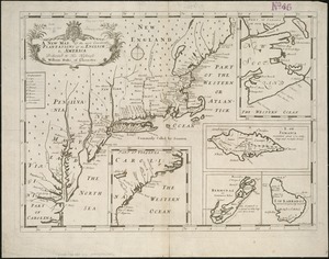
A new map of North America shewing its principal divisions, chief cities, townes, rivers, mountains &c
74.
A New map of North America with the West India Islands : divided according to the preliminary articles of peace, signed at...
75.
A new map of the English empire in America viz. Virginia, Maryland, Carolina, Pennsylvania, New York, New Iarsey, New England,...
76.
A new map of the most considerable plantations of the English in America
77.
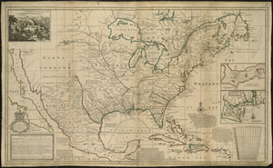
A new map of the north parts of America claimed by France under ye names of Louisiana, Mississipi, Canada, and New France with...
78.
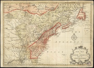
A new map of the United States of North America with the British dominions on that continent &c
79.
A new map of ye north parts of America claimed by France under ye names of Louisiana, Mississipi, Canada & new France with the...
80.
Nieuwe kaart van de Grootbrittannische volkplantingen in Noord America : waar in tevens de Fransche bezittingen en de Landen,...
‹ Prev
Next ›
1
2
3
4
5
6