Toggle navigation
LMEC Home
Exhibitions
Georeferencing
Tools for Teachers
Collections
My Favorites
Sign Up / Log In
Search
Search the map portal
Map Collection
Map Collection
Map Sets
Search
Search
Search for
Search In
All Fields
Creator
Title
Subject
Place
Search All Digital Collections
Advanced Search
136 Results
My Search
Start Over
1895
Remove constraint 1895
Filter your Search
Place
North and Central America
129
United States
116
Massachusetts
35
Boston
18
Suffolk (county)
18
Michigan
17
Middlesex (county)
8
New York
7
more
Place
»
Topic
Boston (Mass.)--Maps
15
Huron, Lake (Mich. and Ont.)--Maps
5
Nautical charts--Superior, Lake
5
Chicago (Ill.)--Maps
4
Chicago (Ill.)--Salaries, etc--Maps
4
Ethnology--Illinois--Chicago--Maps
4
Michigan, Lake--Maps
4
Nautical charts--Huron, Lake (Mich. and Ont.)
4
more
Topic
»
Date
Date range begin
–
Date range end
Current results range from
1830
to
1963
View distribution
Creator
Dougal, William H., 1822-1895
29
U.S. Lake Survey
26
United States. Post Office Dept
23
Macomb, J. N. (John N.), 1810 or 1811-1889
15
Meade, George Gordon, 1815-1872
13
United States. Topographical Bureau
11
Mueller, J. U. (John U.)
10
Raynolds, W. F. (William Franklin), 1820-1894
10
more
Creator
»
Format
Maps/Atlases
135
Books
2
Manuscripts
1
Photographs
1
Prints
1
Georeferenced
Yes
31
No
105
Collection
Norman B. Leventhal Map & Education Center Collection
127
Boston and New England Maps
38
Urban Maps
32
Maritime Charts and Atlases
22
Massachusetts Real Estate Atlases
5
Robert E. Diefenbach Map Collection at Phillips Academy
3
Mapping Boston Collection
1
Town plans, 1830
1
Available to use
No known restrictions
130
Creative Commons license
1
Search Constraints
Sort by relevance
relevance
title
date (asc)
date (desc)
Number of results to display per page
20 per page
10
per page
20
per page
50
per page
100
per page
View results as:
grid view
map view
Search Results
61.
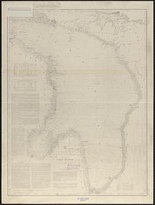
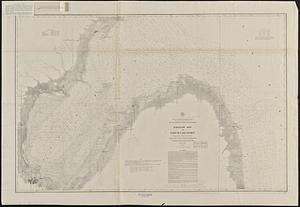
General chart of Lake Huron
62.
Vineyard Sound and Buzzards Bay, Massachusetts
63.
Campaign maps : Army of the Potomac : Map no. 3. White House to Harrison's Landing
64.
Campaign maps : Army of the Potomac : Map no. 2. Williamsburg to White House
65.
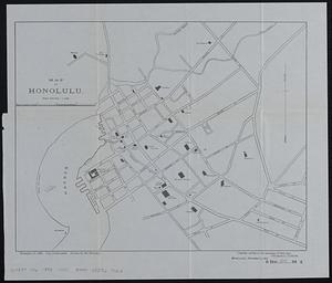
Map of Honolulu
66.
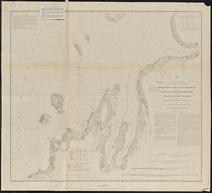
Chart of Isle Royale including north west coast of Lake Superior
67.
Chart of St. Clair Flats
68.
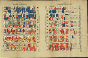
Nationalities map no. 1 - Polk Street to Twelfth, Halsted Street to Jefferson, Chicago ; Nationalities map no. 2 - Polk Street...
69.
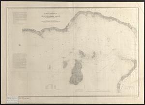
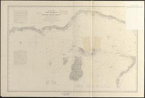
North end of Lake Michigan including the Beaver Island group
70.
North end of Lake Michigan including the Beaver Island group
71.
South end of Lake Huron and head of the St. Clair River
72.
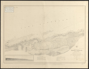
Preliminary chart of Eagle Harbor, Lake Superior : from surveys under the direction of the Topographical Bureau of the War...
73.
Chart no. 1 of River Ste. Marie from Point Iroquois to East Neebish
74.
Chart no. 2 of River Ste. Marie including the part from the entrance of Mud Lake to the East Neebish
75.
Portage Lake and River with part of Keweenaw Bay
76.
North east end of Lake Michigan including Grand and Little Traverse Bays and the Fox and Manitou Islands
77.
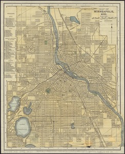
Map of Minneapolis, Minn
78.
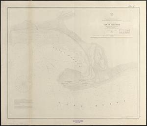
Preliminary chart of Tawas Harbor : (harbor of refuge, Lake Huron)
79.
Preliminary chart of Tawas Harbor : (harbor of refuge, Lake Huron)
80.
Saginaw Bay and part of Lake Huron
‹ Prev
Next ›
1
2
3
4
5
6
7