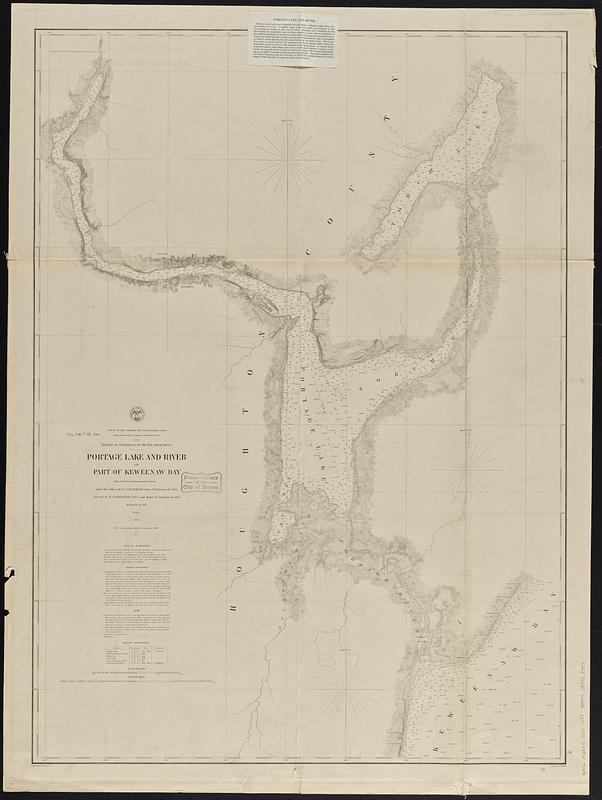
Portage Lake and River with part of Keweenaw Bay
Item Information
- Title:
- Portage Lake and River with part of Keweenaw Bay
- Issuing body:
- U.S. Lake Survey
- Surveyor:
- Graham, J. D. (James Duncan), 1799-1865
- Surveyor:
- Raynolds, W. F. (William Franklin), 1820-1894
- Engraver:
- Dougal, William H., 1822-1895
- Draftsman:
- Mueller, J. U. (John U.)
- Name on Item:
-
projected from a trigonometrical survey under the orders of Col. J.D. Graham, Corps of Engineers in 1863 and of Col. W.F. Raynolds A.D.C. and Major of Engineers in 1864 ; engraved by W.H. Dougal ; drawn by J.U. Mueller
- Date:
-
[1880]
- Format:
-
Maps/Atlases
- Genre:
-
Nautical charts
- Location:
-
Boston Public Library
Norman B. Leventhal Map & Education Center - Collection (local):
-
Norman B. Leventhal Map & Education Center Collection
- Subjects:
-
Portage Lake (Houghton County, Mich.)--Navigation--Maps
Nautical charts--Michigan--Portage Lake (Houghton County)
Nautical charts--Superior, Lake
- Places:
-
MichiganHoughton (county)Portage Lake
- Extent:
- 1 map ; 100 x 73 cm
- Terms of Use:
-
No known copyright restrictions.
No known restrictions on use.
- Publisher:
-
[Washington, D.C.] :
[U.S. Lake Survey]
- Scale:
-
Scale 1:30,000
- Language:
-
English
- Notes:
-
Relief shown by hachures. Depths shown by soundings and isolines.
Includes: Note of authorities -- Sailing Directions -- Note -- Magnetic observations.
"Aids to navigation corrected to January, 1, 1880."
- Notes (date):
-
This date is inferred.
- Identifier:
-
06_01_015620
- Call #:
-
G4112.P728P5 1880 .U83
- Barcode:
-
39999085938957


