Toggle navigation
LMEC Home
Exhibitions
Georeferencing
Tools for Teachers
Collections
My Favorites
Sign Up / Log In
Search
Search the map portal
Map Collection
Map Collection
Map Sets
Search
Search
Search for
Search In
All Fields
Creator
Title
Subject
Place
Search All Digital Collections
Advanced Search
1080 Results
My Search
Start Over
Back Bay Boston
Remove constraint Back Bay Boston
Filter your Search
Place
North and Central America
830
United States
529
Massachusetts
236
Suffolk (county)
178
Boston
172
Canada
115
South America
62
Asia
61
more
Place
»
Topic
Boston (Mass.)--Maps
60
City planning--Massachusetts--Boston--Maps
48
Back Bay (Boston, Mass.)--Maps
47
North America--Maps--Early works to 1800
34
Landowners--Massachusetts--Boston--Maps
26
Real property--Massachusetts--Boston--Maps
26
New England--Maps--Early works to 1800
24
Nova Scotia--Maps--Early works to 1800
24
more
Topic
»
Date
Date range begin
–
Date range end
Current results range from
1565
to
2020
View distribution
Creator
United States. Hydrographic Office
277
Des Barres, Joseph F. W. (Joseph Frederick Wallet), 1722-1824
64
Boston Redevelopment Authority
36
Jefferys, Thomas, -1771
24
Sayer, Robert, 1725-1794
24
Franke, M. (Max)
23
U.S. Lake Survey
22
United States Exploring Expedition (1838-1842)
21
more
Creator
»
Format
Maps/Atlases
1,066
Manuscripts
69
Drawings/Illustrations
10
Objects/Artifacts
3
Prints
3
Books
1
Georeferenced
Yes
54
No
1,026
Collection
Norman B. Leventhal Map & Education Center Collection
942
Maritime Charts and Atlases
481
Boston and New England Maps
264
American Revolutionary War-Era Maps
230
Urban Maps
138
Boston Redevelopment Authority Collection
54
Mapping Boston Collection
39
Library of Congress Collection
35
more
Collection
»
Available to use
No known restrictions
943
Creative Commons license
112
Search Constraints
Sort by relevance
relevance
title
date (asc)
date (desc)
Number of results to display per page
20 per page
10
per page
20
per page
50
per page
100
per page
View results as:
grid view
map view
Search Results
461.
Map of parts of Boston Harbor and its tributaries
462.
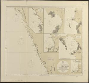
South America, west coast : republication of Brit. Admty. chart no. 1285, with additions to 1877
463.
A plan of the town and harbour of Boston : and the country adjacent with the road from Boston to Concord, shewing the place of...
464.
Water distribution system map, Boston proper, sheet no. 21h
465.
Environs of Boston, from Corey's Hill, Brookline, Mass
466.
Water distribution system map, Boston proper, sheet no. 22h
467.
A map of the colony of Rhode Island : with the adjacent parts of Connecticut, Massachusetts Bay, &c
468.
Apolima, Samoan Group ; Harbour of Oafonu, Isld. of Tutuila, north side ; Hübner Bay, Island of Tutuila ; Harbour of Aur,...
469.
An accurate map of North and South Carolina with their Indian frontiers, shewing in a distinct manner all the mountains,...
470.
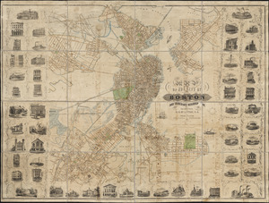
J. Schedler's relief map of Boston and environs
471.
Outline and index map of city of Boston proper
472.
A view of Port Hood, sailing into the harbor : A view of the Plaister Cliffs, in George's Bay
473.
Plan de Boston avec les sondes et les directions pour la navigation : traduit de l'anglais
474.
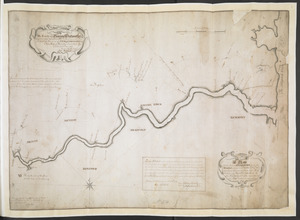
A Map Of the River MERRIMACK from the Atlantick Ocean to Pantuckett Falls describing bounds between His Maj:tys Province of New...
475.
A chart of Delaware Bay and River, containing a full and exact description of the shores, creeks, harbours, soundings, shoals,...
476.
Map of the city of Boston and immediate neighborhood : from original surveys
477.
A draught of Boston Harbor by Capt. Cyprian Southake
478.
A Copy of the Plan returned by his Maj:tys Com:rs for setling the Boundarys between the Provinces of New Hampshire and the...
479.
Harbors on the west coast of Newfoundland : republication of Brit. Admty. charts no. 2918 & 7121, corrected to 1874
480.
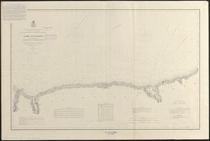
Lake Ontario
‹ Prev
Next ›
1
2
…
20
21
22
23
24
25
26
27
28
…
53
54