Outline and index map of city of Boston proper
Item Information
- Title:
- Outline and index map of city of Boston proper
- Description:
-
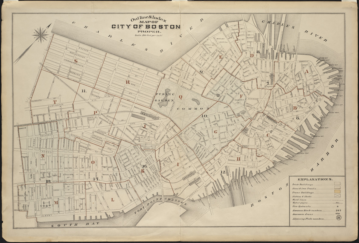
Boston, after the reclamation of Back Bay was completed, is depicted on this outline map. It served as a graphic index to the more detailed atlas pages that comprised the first edition of this urban real estate atlas. Boston real estate atlases, which were published by the Bromley firm from 1883-1938, provide an unrivaled source of information about the internal structure and development of the city during a period of tremendous urban growth. Individual atlas sheets portray city blocks in great detail, indicating property ownership and construction material of individual buildings (i.e. pink for brick, yellow for frame).
- Creator:
- Bromley, George Washington
- Date:
-
[1883]
- Format:
-
Maps/Atlases
- Location:
- Private Collection
- Collection (local):
-
Mapping Boston Collection
- Subjects:
-
Real estate development--Massachusetts--Boston
City planning--Massachusetts--Boston
Boston (Mass.)--Maps
- Places:
-
MassachusettsSuffolk (county)Boston
- Extent:
- 1 map ; 46 x 72 cm.
- Terms of Use:
-
No known copyright restrictions.
This work is licensed for use under a Creative Commons Attribution Non-Commercial Share Alike License (CC BY-NC-SA).

- Publisher:
-
Philadelphia :
Bromley
- Scale:
-
Scale 1:6,000
- Language:
-
English
- Notes:
-
Oriented with north toward the upper right.
Includes architectural explanations.
Appears in Bromley's Atlas of the City of Boston...vol. 1, City Proper. Philadelphia. 1883.
- Notes (date):
-
This date is inferred.
- Identifier:
-
06_01_001221
- Barcode:
-
39999052508619


