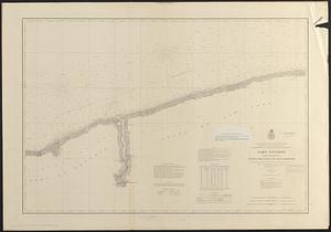
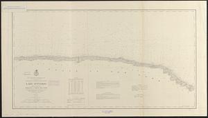
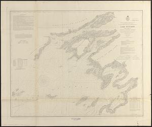
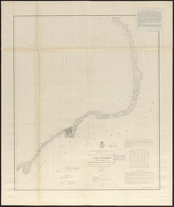
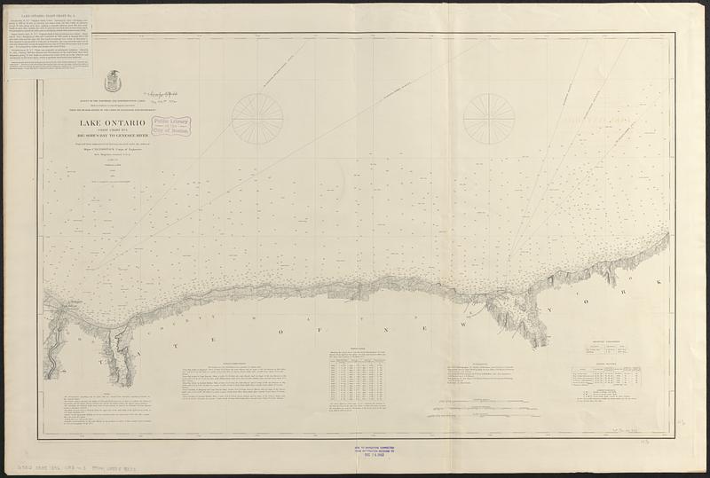
Lake Ontario
Item Information
- Title:
- Lake Ontario
- Title (alt.):
-
Coast chart no. 3, Big Sodus Bay to Genesee River
- Issuing body:
- U.S. Lake Survey
- Surveyor:
- Comstock, C. B. (Cyrus Ballou), 1831-1910
- Engraver:
- Franke, M. (Max)
- Surveyor:
- United States. Army. Corps of Engineers
- Name on Item:
-
projected from trigonometrical surveys executed under the orders of Major C.B. Comstock, Corps of Engineers, Brvt. Brigadier General U.S.A., in 1874, '75 ; reduction by Max. Franke
- Date:
-
[1892]
- Format:
-
Maps/Atlases
- Genre:
-
Nautical charts
- Location:
-
Boston Public Library
Norman B. Leventhal Map & Education Center - Collection (local):
-
Norman B. Leventhal Map & Education Center Collection
- Subjects:
-
Ontario, Lake (N.Y. and Ont.)--Navigation--Maps
Nautical charts--Ontario, Lake (N.Y. and Ont.)
- Places:
-
Ontario, Lake
- Extent:
- 1 map ; 56 x 89 cm
- Terms of Use:
-
No known copyright restrictions.
No known restrictions on use.
- Publisher:
-
[Washington, D.C.] :
[U.S. Lake Survey]
- Scale:
-
Scale 1:80,000
- Language:
-
English
- Notes:
-
Depths shown by soundings.
"Survey of the Northern and Northwestern Lakes, made in obedience to acts of Congress and orders from the Headquarters of the Corps of Engineers, War Department."
"Aids to navigation corrected to October 1889."
Includes note, sailing directions, water table, authorities, table of magnetic variations and table of light-houses.
Stamped in lower margin: Aids to navigation corrected from information received to Dec 24, 1892.
Note issued 1894 tipped-on in upper left corner.
- Notes (date):
-
This date is inferred.
- Identifier:
-
06_01_017457C
- Call #:
-
G3312.O5P5 1892 .U83 no. 3
- Barcode:
-
39999085959383