Toggle navigation
LMEC Home
Exhibitions
Georeferencing
Tools for Teachers
Collections
My Favorites
Sign Up / Log In
Search
Search the map portal
Map Collection
Map Collection
Map Sets
Search
Search
Search for
Search In
All Fields
Creator
Title
Subject
Place
Search All Digital Collections
Advanced Search
947 Results
My Search
Start Over
More Like
commonwealth-oai:f4756d361
Remove constraint More Like: commonwealth-oai:f4756d361
Filter your Search
Place
North and Central America
921
United States
639
Canada
206
New York
192
Quebec
111
Pennsylvania
60
New Jersey
54
Nova Scotia
48
more
Place
»
Topic
United States--History--Revolution, 1775-1783--Maps
305
United States--History--French and Indian War, 1754-1763--Maps
149
Saint Lawrence River--Maps
43
Mexico--Maps
35
Newport (R.I.)--Maps
27
New York (State)--Maps
24
United States--Maps
23
Hudson River (N.Y. and N.J.)--Maps
21
more
Topic
»
Date
Date range begin
–
Date range end
Current results range from
1700
to
1939
View distribution
Creator
Rocque, Mary Ann
29
Holland, Samuel, 1728-1801
25
Montrésor, John, 1736-1799
25
Bellin, Jacques Nicolas, 1703-1772
24
Jefferys, Thomas, -1771
24
Clinton, Henry, Sir, 1738?-1795
19
Robert Sayer and John Bennett (Firm)
15
Hills, John, active 1777-1819
13
more
Creator
»
Format
Maps/Atlases
931
Drawings/Illustrations
11
Documents
5
Prints
1
Georeferenced
Yes
20
No
927
Collection
American Revolutionary War-Era Maps
909
William L. Clements Library Collection
909
Norman B. Leventhal Map & Education Center Collection
38
Maritime Charts and Atlases
1
Urban Maps
1
Available to use
No known restrictions
38
Search Constraints
Sort by relevance
relevance
title
date (asc)
date (desc)
Number of results to display per page
20 per page
10
per page
20
per page
50
per page
100
per page
View results as:
grid view
map view
Search Results
21.
Map of the United States, British & Central America : from state documents & unpublished materials
22.
Map of the United States of America, Mexico, Central America, and the West India Islands
23.
Map of the United States of America, the British Provinces, Mexico, the West Indies and Central America, with part of New...
24.
Map of the United States of America, the British provinces, Mexico, the West Indies and Central America, with part of New...
25.
Map of the United States of North America, upper & lower Canada, New Brunswick, Nova Scotia & British Columbia, Mexico, Cuba,...
26.
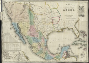
Mapa de los Estados Unidos de Méjico
27.
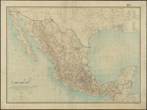
Mexico : from official Mexican and other sources
28.
Mexico : from official Mexican and other sources
29.
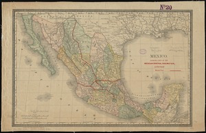
Mexico : showing lines of the Mexican Central Railway Co., Limited
30.
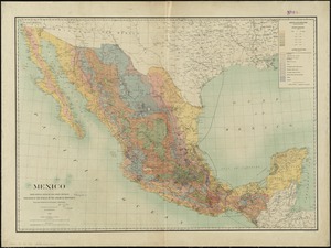
Mexico
31.
Mexico, mapa de las lineas del Ferrocarril Central Mexicano y conecciones
32.
The National Geographic Magazine map of Mexico
33.
A new map of Mexico and adjacent provinces compiled from original documents
34.
Nuevo mapa de Mexico
35.
Pictorial map of Mexico
36.
The Rand-McNally new commercial atlas map of Mexico
37.
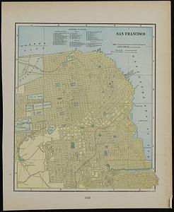
San Francisco ; Mexico
38.
The southwestern railroad system United States and Mexico
39.
Spanish North America
40.
Transportation lines between the United States and Mexico, showing differences of elevation
‹ Prev
Next ›
1
2
3
4
5
6
…
47
48