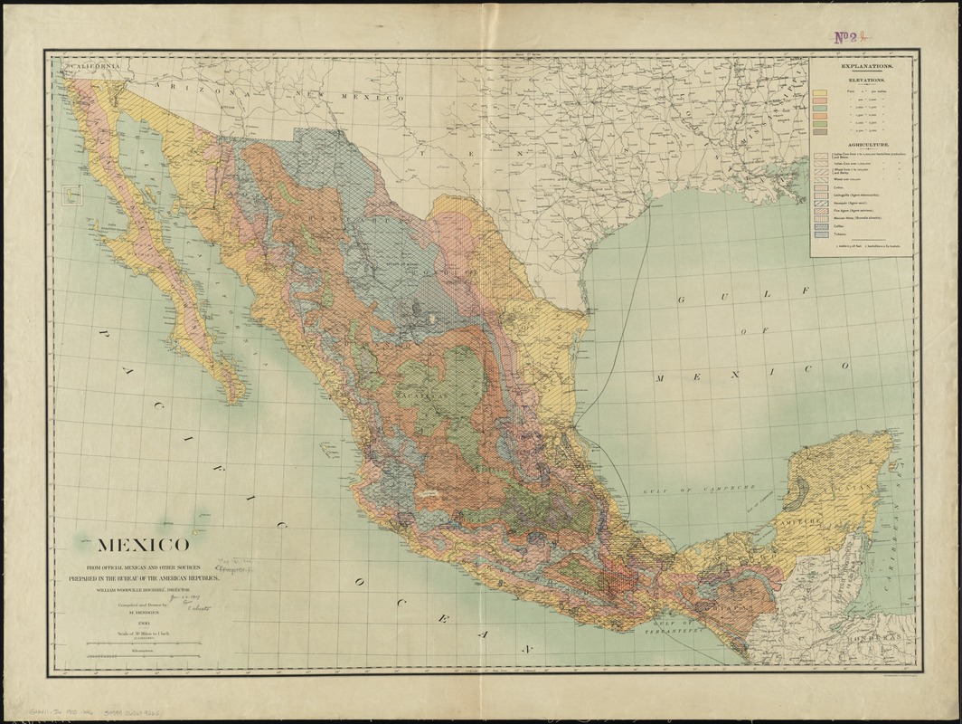
Mexico : from official Mexican and other sources
Item Information
- Title:
- Mexico : from official Mexican and other sources
- Creator:
- Hendges, M.
- Name on Item:
-
prepared in the Bureau of the American Republics ; compiled and drawn by M. Hendges.
- Date:
-
1900
- Format:
-
Maps/Atlases
- Location:
-
Boston Public Library
Norman B. Leventhal Map & Education Center - Collection (local):
-
Norman B. Leventhal Map & Education Center Collection
- Subjects:
-
Crop zones--Mexico--Maps
Agriculture--Mexico--Maps
Mexico--Maps
- Places:
-
Mexico
- Extent:
- 1 map : color ; 69 x 97 cm
- Terms of Use:
-
No known copyright restrictions.
No known restrictions on use.
- Publisher:
-
[Washington, D.C.?] :
Bureau of the American Republics,
- Scale:
-
Scale 1:3,168,000. 50 miles to 1 inch
- Language:
-
English
- Notes:
-
Relief shown by gradient tints.
Shows distribution of crops and elevation.
Prime meridians: Greenwich and Mexico City.
- Identifier:
-
06_01_011767
- Call #:
-
G4411.J6 1900 .H46
- Barcode:
-
39999065689265