Carta geografica general de la republica Mexicana
Item Information
- Title:
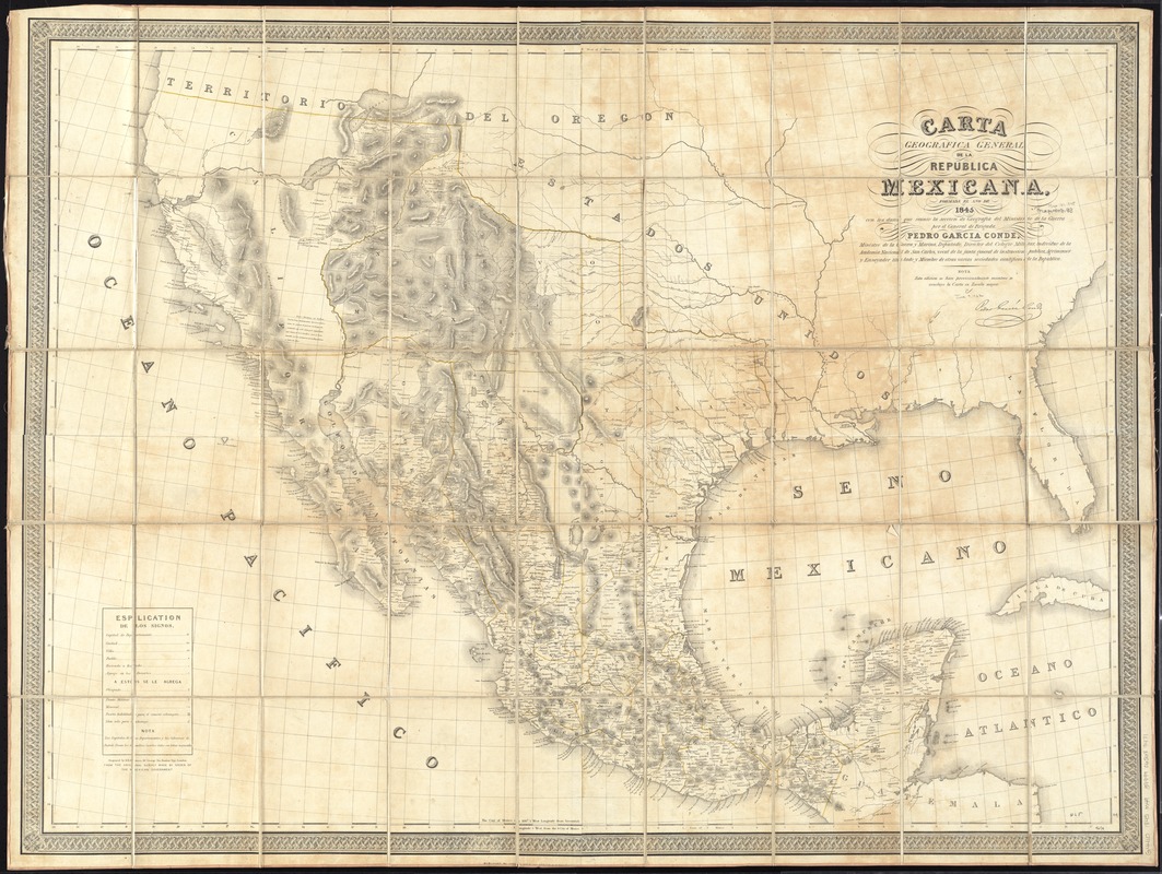
- Carta geografica general de la republica Mexicana
- Creator:
- Mexico. Ministerio de la Guerra
- Name on Item:
-
formada el ano de 1845, con los datos que reunio la seccion de Geografia del Ministerio de la Guerra, por el General de Brigada Pedro Garcia Conde.
- Date:
-
1845
- Format:
-
Maps/Atlases
- Location:
-
Boston Public Library
Norman B. Leventhal Map & Education Center - Collection (local):
-
Norman B. Leventhal Map & Education Center Collection
- Subjects:
-
Mexico--Maps
West (U.S.)--Maps
- Places:
-
Western United States (area)
Mexico
- Extent:
- 1 map : hand colored ; 88 x 121 cm
- Terms of Use:
-
No known copyright restrictions.
No known restrictions on use.
- Publisher:
-
London :
James Wyld,
- Scale:
-
Scale approximately 1:3,800,000
- Language:
-
Spanish
English
- Notes:
-
Map originally on 4 sheets. Boston Public Library copy assembled, dissected and mounted on cloth.
Relief shown by hachures.
Prime meridian: Mexico City.
"Engraved by B.R. Davies, 16 George Str. Euston Squ., London. From the original survey made by order of the Mexican Government."
"Esta edicion se hace provicionalmente mientras se concluye la Carta en Escala mayor."
- Identifier:
-
06_01_011765
- Call #:
-
G4410 1845 .M49
- Barcode:
-
39999065689471


