Toggle navigation
LMEC Home
Exhibitions
Georeferencing
Tools for Teachers
Collections
My Favorites
Sign Up / Log In
Search
Search the map portal
Map Collection
Map Collection
Map Sets
Search
Search
Search for
Search In
All Fields
Creator
Title
Subject
Place
Search All Digital Collections
Advanced Search
441 Results
My Search
Start Over
More Like
commonwealth:z603vv806
Remove constraint More Like: commonwealth:z603vv806
Filter your Search
Place
North and Central America
367
United States
300
New England
97
Canada
48
New York
44
Middle Atlantic
40
North America
39
Suffolk (county)
38
more
Place
»
Topic
New England--Maps--Early works to 1800
97
Middle Atlantic States--Maps--Early works to 1800
38
United States--History--Revolution, 1775-1783--Maps--Early works to 1800
38
North America--Maps--Early works to 1800
27
Northeastern States--Maps--Early works to 1800
19
Boston (Mass.)--History--Revolution, 1775-1783--Maps--Early works to 1800
18
United States--Maps--Early works to 1800
15
Indians of North America--Maps--Early works to 1800
14
more
Topic
»
Date
Date range begin
–
Date range end
Current results range from
1617
to
1999
View distribution
Creator
Jefferys, Thomas, -1771
38
Faden, William, 1749-1836
36
Le Rouge, Georges-Louis
24
Sayer, Robert, 1725-1794
24
Des Barres, Joseph F. W. (Joseph Frederick Wallet), 1722-1824
22
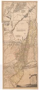
Jefferys, Thomas, d. 1771
14
Robert Sayer and John Bennett (Firm)
12
Korn, Christoph Heinrich, 1726-1783
10
more
Creator
»
Format
Maps/Atlases
398
Prints
32
Manuscripts
27
Drawings/Illustrations
9
Books
2
Georeferenced
Yes
21
No
420
Collection
American Revolutionary War-Era Maps
386
Richard H. Brown Revolutionary War Map Collection at Mount Vernon
293
Norman B. Leventhal Map & Education Center Collection
89
Boston and New England Maps
37
Mapping Boston Collection
24
MacLean Collection Map Library
15
Maritime Charts and Atlases
15
Sidney R. Knafel Map Collection at Phillips Academy
15
more
Collection
»
Available to use
Creative Commons license
337
No known restrictions
69
Search Constraints
Sort by relevance
relevance
title
date (asc)
date (desc)
Number of results to display per page
20 per page
10
per page
20
per page
50
per page
100
per page
View results as:
grid view
map view
Search Results
81.
A general map of the Middle British Colonies, in America: viz Virginia, Mariland, Delaware, Pensilvania, New-Jersey, New-York,...
82.
A map exhibiting a general view of the roads and inland navigation of Pennsylvania, and part of the adjacent states :...
83.
Map no. I
84.
A map of Pensilvania, New-Jersey, New-York, and the three Delaware counties
85.
A map of that part of America where a degree of latitude was measured for the Royal Society
86.
Map of the country between and bordering the Delaware River and Chesapeake Bay : showing roads to Philadelphia and localities
87.
A map of the middle British colonies in North America : first published by Mr. Lewis Evans, of Philadelphia, in 1755; and since...
88.
Map of the middle states of America : comprehends New-York, New-Jersey, Pennsylvania, Delaware, and the territory N.W. of Ohio
89.
A map of the most inhabited part of Virginia containing the whole province of Maryland : with part of Pensilvania, New Jersey...
90.
A map of the most inhabited part of Virginia containing the whole province of Maryland with part of Pensilvania, New Jersey and...
91.
La Pensilvania, la Nuova York, il Jersey Settentrio[na]le : con la parte occidentale del Connecticut, Massachusset-s-bay e...
92.
Pensylvania Nova Jersey et Nova York cum Regionibus ad Fluvium Delaware in America sitis
93.
The provinces of New York and New Jersey; with part of Pensilvania, and the province of Quebec
94.
Virginia, Maryland, Pennsilvania, east & west New Jarsey
95.
An Accurate map of New Hampshire in New England, from a late survey
96.
An accurate map of Rhode Island, part of Connecticut and Massachusets, shewing Admiral Arbuthnot's station in blocking up...
97.
An accurate map of Rhode Island, part of Connecticut and Massachusets, shewing Admiral Arbuthnot's station in blocking up...
98.
An accurate map of the four New England states : shewing in a distinct manner all the mountains, forts, rivers, swamps,...
99.
An actual survey of the sea coast from New York to the I. Cape Brition : with tables of the direct and thwart courses &...
100.
Bowles's new pocket map of the most inhabited part of New England : comprehending the provinces of Massachusets Bay and New...
‹ Prev
Next ›
1
2
3
4
5
6
7
8
9
…
22
23


![La Pensilvania, la Nuova York, il Jersey Settentrio[na]le](https://bpldcassets.blob.core.windows.net/derivatives/images/commonwealth:z603vq53g/image_thumbnail_300.jpg)