Toggle navigation
LMEC Home
Exhibitions
Georeferencing
Tools for Teachers
Collections
My Favorites
Sign Up / Log In
Search
Search the map portal
Map Collection
Map Collection
Map Sets
Search
Search
Search for
Search In
All Fields
Creator
Title
Subject
Place
Search All Digital Collections
Advanced Search
337 Results
My Search
Start Over
More Like
commonwealth:z603vv407
Remove constraint More Like: commonwealth:z603vv407
Filter your Search
Place
North and Central America
270
United States
208
Suffolk (county)
72
Boston
70
Massachusetts
38
New York
32
Canada
28
North America
27
more
Place
»
Topic
Boston (Mass.)--Maps--Early works to 1800
46
Boston Harbor (Mass.)--Maps--Early works to 1800
21
Boston (Mass.)--History--Revolution, 1775-1783--Maps--Early works to 1800
19
North America--Maps--Early works to 1800
18
New England--Maps--Early works to 1800
11
United States--History--Revolution, 1775-1783--Maps--Early works to 1800
11
Vues d'optique
10
Fortification--Massachusetts--Boston--Maps--Early works to 1800
9
more
Topic
»
Date
Date range begin
–
Date range end
Current results range from
1694
to
1879
View distribution
Creator
Faden, William, 1749-1836
33
Jefferys, Thomas, -1771
30
Le Rouge, Georges-Louis
24
Des Barres, Joseph F. W. (Joseph Frederick Wallet), 1722-1824
22
Sayer, Robert, 1725-1794
19
Korn, Christoph Heinrich, 1726-1783
11
Raspe, Gabriel Nicolaus, 1712-1785
11
Simcoe, John Graves, 1752-1806
10
more
Creator
»
Format
Maps/Atlases
294
Prints
32
Manuscripts
25
Drawings/Illustrations
9
Books
2
Georeferenced
Yes
18
No
319
Collection
American Revolutionary War-Era Maps
327
Richard H. Brown Revolutionary War Map Collection at Mount Vernon
293
Boston and New England Maps
41
Norman B. Leventhal Map & Education Center Collection
38
Urban Maps
25
Mapping Boston Collection
8
Maritime Charts and Atlases
6
Library of Congress Collection
3
more
Collection
»
Available to use
Creative Commons license
305
No known restrictions
32
Search Constraints
Sort by date (asc)
relevance
title
date (asc)
date (desc)
Number of results to display per page
20 per page
10
per page
20
per page
50
per page
100
per page
View results as:
grid view
map view
Search Results
41.
[Map of Florida, Carolina, and the Gulf Coast]
42.
[Map of the Allegheny and Ohio Rivers] ; Franzosische see kusten von Provence zwischen Marseille und Toulon = : Cotes maritimes...
43.
Plan der gegend des Ohio Flusses, wo ohnweit da von am 9 July 1755, zwischen denen Franzofichen u. Engl trouppen ein hiziges...
44.
Plan des jenigen treffen welches am 8. Sept 1755. zwischen dem Engl. Gen. Johnson, und dem Franz. Gen. Diesckau welcher dabey...
45.
Plan du fort et ville de Louisbourg dans l'Isle Roale
46.
A view of the landing place above the town of Quebec, describing the assault of the enemys post, on the banks of the River St....
47.
An accurate map of His Majesty's province of New-Hampshire in New England : taken from actual surveys of all the inhabited...
48.
Karte von dem Ostlichen-Stucke von Neu Franckreich oder Canada in America : besonders aber Acadia und Neu Schottland
49.
A general map of North America : in which is express'd the several new roads, forts, engagements, &c, taken from actual surveys...
50.
A map of the most inhabited part of New England : containing the provinces of Massachusets Bay and New Hampshire, with the...
51.
A map of the most inhabited part of New England : containing the provinces of Massachusets Bay and New Hampshire, with the...
52.
A new map of North America wherein the British Dominions in the continent of North America : and on the islands of the West...
53.
A south east view of the city of New York, in North America = Vue de sud est de la ville de New York, dans l'Amerique...
54.
A south west view of the city of New York, in North America = Vue de sud ouest de la ville de New York, dans l'Amerique...
55.
Theodolite's pattern, shewing the provinces in North America which were in the respective possessions of England, France &...
56.
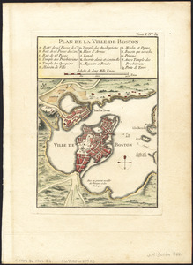
Plan de la ville de Boston
57.
Plan de la ville de Boston
58.
Plan de la ville de Boston
59.
Plan de la ville et du port de Boston : capitale de la Nouvelle Angleterre
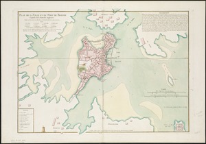
60.
Plan de la ville et du port de Boston : capitale de la Nouvelle Angleterre : erigée prémierement en 1630, et en 1735 elle fut...
‹ Prev
Next ›
1
2
3
4
5
6
7
…
16
17
![[Map of Florida, Carolina, and the Gulf Coast]](https://bpldcassets.blob.core.windows.net/derivatives/images/commonwealth:z603vr379/image_thumbnail_300.jpg)
![[Map of the Allegheny and Ohio Rivers] ; Franzosische see kusten von Provence zwischen Marseille und Toulon =](https://bpldcassets.blob.core.windows.net/derivatives/images/commonwealth:z603vr31n/image_thumbnail_300.jpg)