Toggle navigation
LMEC Home
Exhibitions
Georeferencing
Tools for Teachers
Collections
My Favorites
Sign Up / Log In
Search
Search the map portal
Map Collection
Map Collection
Map Sets
Search
Search
Search for
Search In
All Fields
Creator
Title
Subject
Place
Search All Digital Collections
Advanced Search
331 Results
My Search
Start Over
More Like
commonwealth:z603vq683
Remove constraint More Like: commonwealth:z603vq683
Filter your Search
Place
North and Central America
256
North America
235
United States
93
Northeastern United States
42
Canada
27
New England
17
New York
15
New Jersey
14
more
Place
»
Topic
North America--Maps--Early works to 1800
240
Northeastern States--Maps--Early works to 1800
46
United States--Maps--Early works to 1800
25
Great Britain--Colonies--America--Maps--Early works to 1800
20
Canada--Maps--Early works to 1800
18
New England--Maps--Early works to 1800
16
Middle Atlantic States--Maps--Early works to 1800
11
New Jersey--Maps--Early works to 1800
10
more
Topic
»
Date
Date range begin
–
Date range end
Current results range from
1528
to
1899
View distribution
Creator
Mitchell, John, 1711-1768
18
Sayer, Robert, 1725-1794
17
Gibson, J. (John), active 1750-1792
16
Jefferys, Thomas, -1771
14
Anville, Jean Baptiste Bourguignon d', 1697-1782
13
Bowen, Emanuel, 1693 or 1694-1767
11
Moll, Herman, d. 1732
11
Kitchin, Thomas, 1719-1784
10
more
Creator
»
Format
Maps/Atlases
331
Manuscripts
3
Georeferenced
Yes
11
No
320
Collection
American Revolutionary War-Era Maps
256
Norman B. Leventhal Map & Education Center Collection
134
New York Public Library Collection
86
MacLean Collection Map Library
68
Richard H. Brown Revolutionary War Map Collection at Mount Vernon
21
Mapping Boston Collection
17
Sidney R. Knafel Map Collection at Phillips Academy
10
New-York Historical Society Collection
4
more
Collection
»
Available to use
Creative Commons license
127
No known restrictions
123
Search Constraints
Sort by relevance
relevance
title
date (asc)
date (desc)
Number of results to display per page
20 per page
10
per page
20
per page
50
per page
100
per page
View results as:
grid view
map view
Search Results
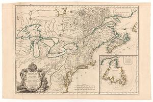
41.
Carte des pays connus sous le nom de Canada dans laquelle sont distinguées les possessions françoises, & angl' : dediée et...
42.
Carte du théatre de la guerre entre les Anglais et les Américains
43.
Carte du théatre de la guerre entre les Anglais et les Américains
44.
Carte d'une partie du Nord Amerique dans la quelle se trouvent les isles et les provinces suivantes : l'Isle de la Terre-Neuve...
45.
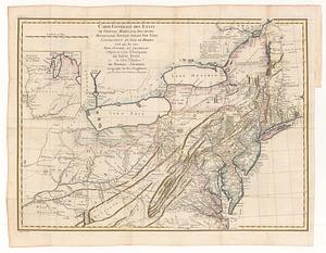
Carte générale des etats de Virginie, Maryland, Delaware, Pensilvanie, Nouveau-Jersey, New-York, Connecticut et Isle de Rhodes...
46.
Carte reduite des costes orientales de l'Amerique septentrionale : 1re. feuille contenant L'Isle Royale, L'Accadie, La Baye...
47.
A chart of the sea coast of New Foundland, New Scotland, New England, New York, New Jersey, with Virginia and Maryland
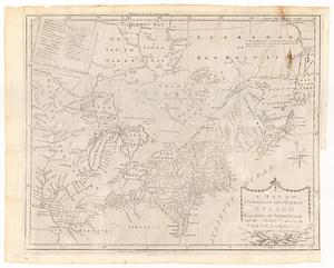
48.
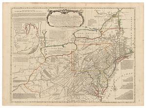
A general map of the middle British colonies, in America : viz Virginia, Màriland, Dèlaware, Pensilvania, New-Jersey, New-York,...
49.
A general map of the middle British colonies in America : viz. Virginia, Maryland, Delaware, Pensilvania, New-Jersey, New-York,...
50.
A general map of the Middle British Colonies in America viz. Virginia, Maryland, Delaware, Pensilvania, New-Jersey New York,...
51.
A general map of the middle British colonies in America, viz. Virginia, Maryland, Delaware, Pensilvania, New-Jersey, New York,...
52.
[Globe gore featuring North American coastline]
53.
Karte von Neu England, Neu Yorck und Pensilvanien : sur Allgemeinen historie der reisen
54.
A large draught of New England, New York and Long Island
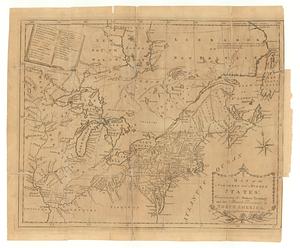
55.
A map of the middle British colonies in North America : first published by Mr. Lewis Evans, of Philadelphia, in 1755; and since...
56.
A map of the middle British colonies in North America : first published by Mr. Lewis Evans, of Philadelphia, in 1755; and since...
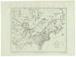
57.
A map of the northern and middle states : comprehending the western territory and the British dominions in North America from...
58.
A map of the northern and middle states : comprehending the western territory and the British dominions in North America ;...
59.
A map of the northern and middle states : comprehending the western territory and the British dominions in North America :...
60.
A map of the Province of New York, with part of Pensilvania, and New England : from an actual survey by Captain Montresor,...
‹ Prev
Next ›
1
2
3
4
5
6
7
…
16
17


![[Globe gore featuring North American coastline]](https://bpldcassets.blob.core.windows.net/derivatives/images/commonwealth:qb98n804g/image_thumbnail_300.jpg)