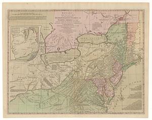
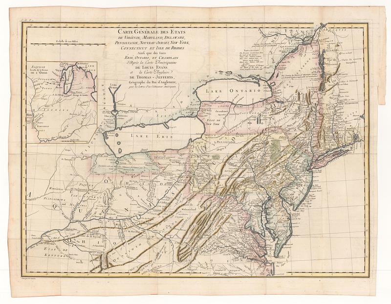
Carte générale des etats de Virginie, Maryland, Delaware, Pensilvanie, Nouveau-Jersey, New-York, Connecticut et Isle de Rhodes ainsi qui des lacs Erié, Ontario, et Champlain d'après la carte amèriquaine de Louis Evans et la carte anglaise de Thomas-Jefferys, géographe du roi d'Angleterre, pour les lettres d'un cultivateur amériquain
This map is also available in American Revolutionary Geographies Online (ARGO), a collections portal especially built for material relating to the American Revolutionary War Era. Visit ARGO to learn more about this item and explore the historical geography of North America in the late eighteenth century.
Item Information
- Title:
- Carte générale des etats de Virginie, Maryland, Delaware, Pensilvanie, Nouveau-Jersey, New-York, Connecticut et Isle de Rhodes ainsi qui des lacs Erié, Ontario, et Champlain d'après la carte amèriquaine de Louis Evans et la carte anglaise de Thomas-Jefferys, géographe du roi d'Angleterre, pour les lettres d'un cultivateur amériquain
- Contributor:
- St. John de Crèvecoeur, J. Hector, 1735-1813
- Publisher:
- Cuchet, Gaspard-Joseph, 1750-1833
- Date:
-
1787
- Format:
-
Maps/Atlases
- Location:
- MacLean Collection Map Library
- Collection (local):
-
MacLean Collection Map Library
- Subjects:
-
Northeastern States--Maps--Early works to 1800
- Places:
-
Northeastern United States (area)
- Extent:
- 1 map ; 481 x 656 mm
- Terms of Use:
-
Public Domain/No known restrictions on use. Contact host institution to download image.
Contact host institution for more information.
- Publisher:
-
Paris :
Cuchet
- Language:
-
French
- Notes:
-
"Gravé par P.F. Tardieu."
"T. LI. P.1."
- Identifier:
-
MC_3477
- Call #:
-
3477