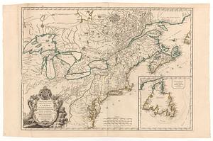
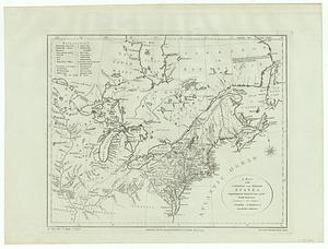
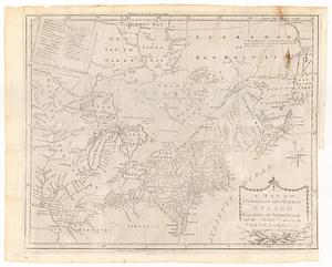
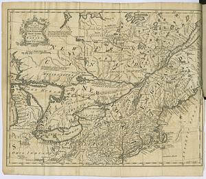
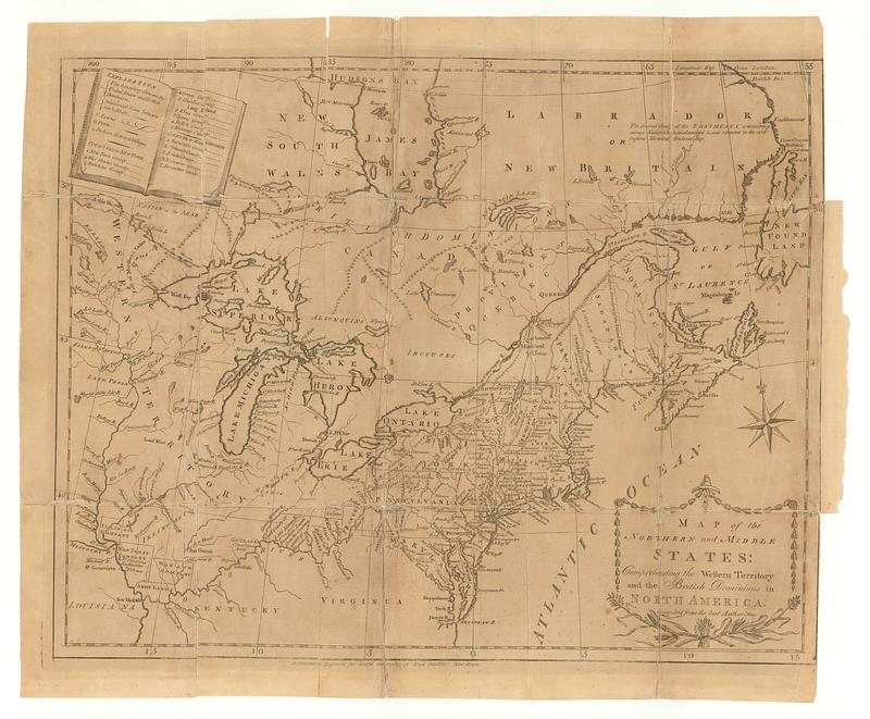
A map of the northern and middle states : comprehending the western territory and the British dominions in North America : compiled from the best authorities
This map is also available in American Revolutionary Geographies Online (ARGO), a collections portal especially built for material relating to the American Revolutionary War Era. Visit ARGO to learn more about this item and explore the historical geography of North America in the late eighteenth century.
Item Information
- Title:
- A map of the northern and middle states : comprehending the western territory and the British dominions in North America : compiled from the best authorities
- Contributor:
- Doolittle, Amos, 1754-1832
- Publisher:
- Kollock, Shepard, 1750-1839
- Date:
-
[1789]
- Format:
-
Maps/Atlases
- Location:
- MacLean Collection Map Library
- Collection (local):
-
MacLean Collection Map Library
- Subjects:
-
Northeastern States--Maps--Early works to 1800
Canada--Maps--Early works to 1800
- Places:
-
Northeastern United States (area)
Canada
- Extent:
- 1 map ; 317 x 400 mm
- Terms of Use:
-
Public Domain/No known restrictions on use. Contact host institution to download image.
Contact host institution for more information.
- Publisher:
-
Elizabethtown :
Kollock, Shepard
- Edition:
- First state
- Language:
-
English
- Notes:
-
"Delineated & engrav'd for Morses geography by Amos Doolittle New-Haven."
- Notes (date):
-
This date is inferred.
- Identifier:
-
MC_22584
- Call #:
-
22584