Toggle navigation
LMEC Home
Exhibitions
Georeferencing
Tools for Teachers
Collections
My Favorites
Sign Up / Log In
Search
Search the map portal
Map Collection
Map Collection
Map Sets
Search
Search
Search for
Search In
All Fields
Creator
Title
Subject
Place
Search All Digital Collections
Advanced Search
186 Results
My Search
Start Over
More Like
commonwealth:z603vh26b
Remove constraint More Like: commonwealth:z603vh26b
Filter your Search
Place
North and Central America
117
United States
57
West Indies
51
Canada
22
North America
20
Caribbean Sea
13
New York
11
Boston
10
more
Place
»
Topic
West Indies--Maps
52
United States--Maps
27
North America--Maps
20
Canada--Maps
14
Caribbean Area--Maps
13
Mexico, Gulf of--Maps
13
Central America--Maps
11
Boston (Mass.)--Maps
9
more
Topic
»
Date
Date range begin
–
Date range end
Current results range from
1700
to
1993
View distribution
Creator
Reid, John, 1764?-1828
11
Bellin, Jacques Nicolas, 1703-1772
9
Farwell, John Whittemore, 1843-1929
9
Kitchin, Thomas, 1718-1784
9
Carleton, Osgood, 1742-1816
6
Tanner, Benjamin, 1775-1848
6
Anderson, Alexander, 1775-1870
5
Gibson, J. (John), active 1750-1792
5
more
Creator
»
Format
Maps/Atlases
186
Manuscripts
12
Georeferenced
Yes
22
No
164
Collection
American Revolutionary War-Era Maps
147
American Antiquarian Society Collection
138
Norman B. Leventhal Map Center Collection
39
Maritime Charts and Atlases
9
William L. Clements Library Collection
9
Boston and New England Maps
1
Available to use
No known restrictions
39
Creative Commons license
1
Search Constraints
Sort by date (asc)
relevance
title
date (asc)
date (desc)
Number of results to display per page
20 per page
10
per page
20
per page
50
per page
100
per page
View results as:
grid view
map view
Search Results
1.
The Gulf coast from the Mississippi Delta to the Bay of St. Joseph
2.
An accurate map of the West Indies : exhibiting not only all the islands possess'd by the English, French, Spaniards & Dutch...
3.
A new & accurate map of Louisiana, with part of Florida and Canada, : and the adjacent countries drawn from surveys assisted by...
4.
North America. : Performed under the patronage of Louis Duke of Orleans, first prince of the blood
5.
An accurate map of the West Indies
6.
A new & accurate map of the provinces of North & South Carolina Georgia &c
7.
Carte des pays connus sous le nom de Canada, : dans laquelle sont distinguées les possessions françoises, et angl?
8.
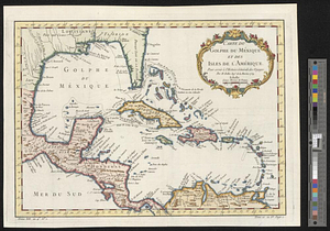
Carte du Golphe du Méxique et des isles de l'Amérique : pour servir à l'Histoire générale des voyages
9.
A Map of the western parts of the colony of Virginia
10.
Carolinae Floridae nec non insularum Bahamensium : cum partibus adjacendibus delineatio ad Exemplar Londinense in lucem edita a...
11.
Carte de l'Amerique Septentrionale depuis le 28 degré de latitude jusqu'au 72
12.
A Map of New England & ye country adjacent, : extending northward to Quebec, & westward to Niagara, on Lake Ontario; shewing...
13.
Partie de l'Amerique Septentrionale, : qui comprend le cours de l'Ohio, la Nlle. Angleterre, la Nlle. York, le New Jersey, la...
14.
Carte de la Caroline et Georgie. : Pour servir à l'Histoire générale des voyages
15.
Carte de la Caroline et Georgie. : Pour servir à l'Histoire générale des voyages
16.
Carte de la Floride, de la Louisiane, et pays voisins. : Pour servir à l'Histoire générale des voyages
17.
Carte de la Nouvelle Angleterre, Nouvelle Yorck, et Pensilvanie. : Pour servir à l'Histoire générale des voyages
18.
Carte de la Virginie, : de la Baye Chesapeack, et pays voisins. : Pour servir à l'Histoire générale des voyages. : Tirée...
19.
Karte von den seen in Canada
20.
A Map of that part of America which was the principal seat of war in 1756
‹ Prev
Next ›
1
2
3
4
5
…
9
10