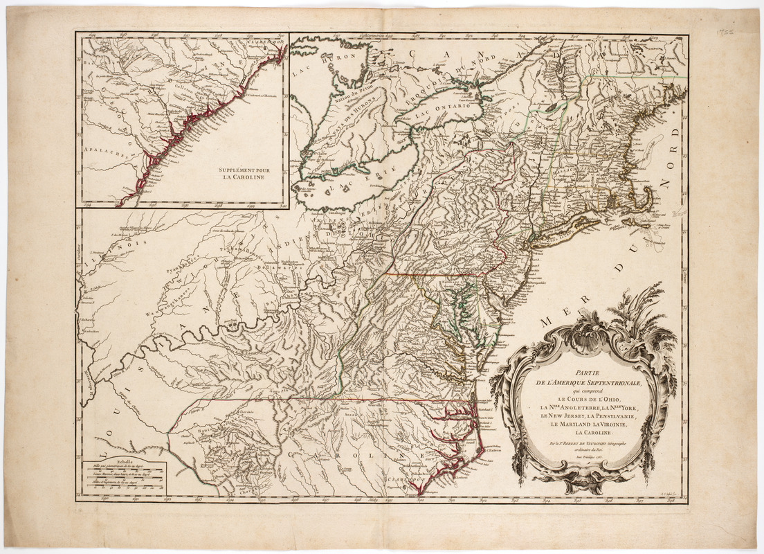
Partie de l'Amerique Septentrionale, : qui comprend le cours de l'Ohio, la Nlle. Angleterre, la Nlle. York, le New Jersey, la Pensylvanie, le Maryland, la Virginie, la Caroline
This map is also available in American Revolutionary Geographies Online (ARGO), a collections portal especially built for material relating to the American Revolutionary War Era. Visit ARGO to learn more about this item and explore the historical geography of North America in the late eighteenth century.
Item Information
- Title:
- Partie de l'Amerique Septentrionale, : qui comprend le cours de l'Ohio, la Nlle. Angleterre, la Nlle. York, le New Jersey, la Pensylvanie, le Maryland, la Virginie, la Caroline
- Description:
-
Subject: Map of the east coast and the middle west portion of the United States. Shows locations of various Native American peoples.
- Creator:
- Robert de Vaugondy, Gilles, 1688-1766
- Donor:
- Farwell, John Whittemore, 1843-1929
- Engraver:
- Haussard, Catherine
- Name on Item:
-
Par le Sr. Robert de Vaugondy géographe du Roi. Avec privilege 1755. ; M.C. Haussard fecit.
- Date:
-
[1755]
- Format:
-
Maps/Atlases
- Location:
- American Antiquarian Society
- Collection (local):
-
American Antiquarian Society Collection
- Subjects:
-
United States--Maps
Ohio River Valley--Maps
- Places:
-
Ohio River
- Extent:
- 1 map : engraving, hand colored ; 48 x 62 cm., on sheet 55 x 76 cm.
- Terms of Use:
-
Public Domain/No known restrictions on use. Contact host institution to download image.
Contact host institution for more information.
- Publisher:
-
Paris? :
[s.n.]
- Scale:
-
Scale [ca. 1:3,000,000]
- Language:
-
French
- Catalog Record:
-
http://catalog.mwa.org/vwebv/holdingsInfo?bibId=489332
- Notes:
-
Relief shown pictorially.
"Supplément pour la Caroline."
- Notes (date):
-
This date is inferred.


