Toggle navigation
LMEC Home
Exhibitions
Georeferencing
Tools for Teachers
Collections
My Favorites
Sign Up / Log In
Search
Search the map portal
Map Collection
Map Collection
Map Sets
Search
Search
Search for
Search In
All Fields
Creator
Title
Subject
Place
Search All Digital Collections
Advanced Search
8870 Results
My Search
Start Over
More Like
commonwealth:x059cc64d
Remove constraint More Like: commonwealth:x059cc64d
Filter your Search
Place
North and Central America
6,101
United States
5,017
Massachusetts
2,133
Europe
1,396
Suffolk (county)
1,216
Boston
1,189
Canada
449
Asia
438
more
Place
»
Topic
Boston (Mass.)--Maps
752
United States--Maps
282
Real property--Massachusetts--Boston--Maps
195
Massachusetts--Maps
166
City planning--Massachusetts--Boston--Maps
159
Landowners--Massachusetts--Boston--Maps
142
New England--Maps
104
North America--Maps--Early works to 1800
103
more
Topic
»
Date
Date range begin
–
Date range end
Current results range from
1482
to
2023
View distribution
Creator
United States. Hydrographic Office
595
Boston Redevelopment Authority
164
O.H. Bailey & Co
148
Des Barres, Joseph F. W. (Joseph Frederick Wallet), 1722-1824
124
United States. Post Office Dept
120
Ptolemy, 2nd cent
100
Walling, Henry Francis, 1825-1888
94
Geological Survey (U.S.)
87
more
Creator
»
Format
Maps/Atlases
8,810
Manuscripts
215
Prints
56
Books
36
Objects/Artifacts
10
Drawings/Illustrations
8
Posters
5
Georeferenced
Yes
885
No
7,985
Collection
Norman B. Leventhal Map & Education Center Collection
8,729
Boston and New England Maps
2,366
Urban Maps
2,146
Maritime Charts and Atlases
1,083
American Revolutionary War-Era Maps
638
Boston Redevelopment Authority Collection
193
Mapping Boston Collection
20
Massachusetts Real Estate Atlases
12
more
Collection
»
Available to use
No known restrictions
8,672
Creative Commons license
71
Search Constraints
Sort by relevance
relevance
title
date (asc)
date (desc)
Number of results to display per page
20 per page
10
per page
20
per page
50
per page
100
per page
View results as:
grid view
map view
Search Results
21.
New historical map of metropolitan Boston
22.
Outline map of the various Boston metropolitan districts
23.
Principal cities of the United States
24.
Road map of the Boston district showing the metropolitan park system.
25.
Fenway urban renewal area : major thoroughfares
26.
Parker Hill-Fenway project no. Mass. R-48 : police signal system, fire alarm system and M.T.A. facilities
27.
The 1976 proposed regional open space plan
28.
Boston's bikemap : Arlington, Belmont, Brookline, Cambridge, Chelsea, Everett, Lexington, Malden, Medford, Needham, Newton,...
29.
Major transportation system : Boston region MAPC area
30.
Master highway plan metropolitan Boston showing the Massachusetts turnpike, route 128 (circumferential highway), Boston central...
31.
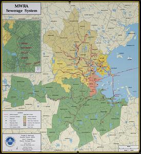
MWRA sewerage system
32.
The regional open space system : [Boston, Massachusetts metropolitan area]
33.
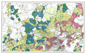
Residential security map of Boston, Mass.
34.
Annexation map
35.
Atlas of the city of Boston : Boston proper : from actual surveys and official plans
36.
Atlas of the city of Boston : Boston proper and Back Bay : from actual surveys and official plans
37.
Atlas of the city of Boston : Boston proper and Back Bay : from actual surveys and official plans
38.
Atlas of the city of Boston : Boston proper and Back Bay : from actual surveys and official plans
39.
Atlas of the city of Boston : Boston proper and Back Bay : from actual surveys and official plans
40.
Atlas of the city of Boston : Boston proper and Back Bay : from actual surveys and official plans
‹ Prev
Next ›
1
2
3
4
5
6
…
443
444