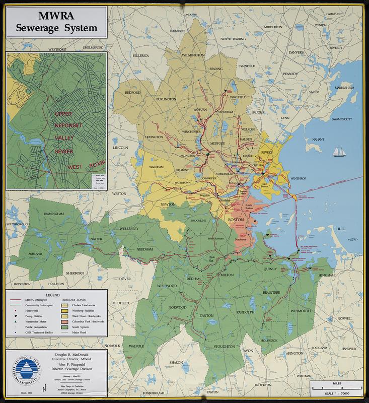
MWRA sewerage system
Item Information
- Title:
- MWRA sewerage system
- Cartographer:
- Applied Geographics, Inc.
- Publisher:
- Massachusetts Water Resources Authority
- Name on Item:
-
Massachusetts Water Resources Authority ; map design & production Applied Geographics, Inc.
- Date:
-
1994
- Format:
-
Maps/Atlases
- Location:
-
Boston Public Library
Norman B. Leventhal Map & Education Center - Collection (local):
-
Applied Geographics, Inc. Records
- Subjects:
-
Boston Metropolitan Area (Mass.)--Maps
Sewerage--Massachusetts--Boston Metropolitan Area--Maps
Sewage--Purification--Massachusetts--Boston Metropolitan Area--Maps
- Places:
-
MassachusettsSuffolk (county)Boston
- Extent:
- 1 map : color, plastic-coated ; 91 x 84 cm
- Terms of Use:
-
No known copyright restrictions.
No known restrictions on use.
- Publisher:
-
Boston :
Massachusetts Water Resources Authority
- Scale:
-
Scale 1:70,000
- Language:
-
English
- Notes:
-
Shows tributary zones, interceptor, headworks, pump station, wastewater meter, public connection and CSO treatment facility.
Inset: Upper Neponset Valley sewer.
"March, 1994."
"Basemap: MassGIS."
"Thematic data: MWRA Sewerage Division."
- Identifier:
-
06_01_018948
- Call #:
-
AppGeo Folder 5 no. 2
- Barcode:
-
30000007789881