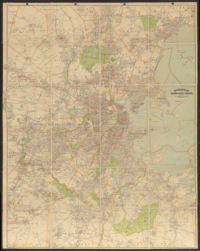
New historical map of metropolitan Boston
Item Information
- Title:
- New historical map of metropolitan Boston
- Cartographer:
- Geo. H. Walker & Co.
- Date:
-
1898
- Format:
-
Maps/Atlases
- Location:
-
Boston Public Library
Norman B. Leventhal Map & Education Center - Collection (local):
-
Norman B. Leventhal Map & Education Center Collection
- Subjects:
-
Landowners--Massachusetts--Boston Metropolitan Area--History--Maps
Boston (Mass.)--History
Boston Metropolitan Area (Mass.)--Maps
- Places:
-
MassachusettsSuffolk (county)Boston
- Extent:
- 1 map : color, sectioned and mounted on cloth ; 181 x 146 cm
- Terms of Use:
-
No known copyright restrictions.
No known restrictions on use.
- Publisher:
-
Boston :
Published by Geo. H. Walker & Co.
- Scale:
-
Scale 1:21,120. 1 mile = 3 inches
- Language:
-
English
- Notes:
-
Oriented with north towards the upper right. Compass erroneously shows north towards the upper left.
Shows original shoreline of Boston proper, parks, railroads, roads, locations of historical importance, and some buildings with names of property owners.
Covers area bounded by Burlington, Dover, Swampscott, and Braintree.
Relief shown by spot heights.
Scale given on pasted-on slip below title.
- Identifier:
-
06_01_016803
- Call #:
-
G3764.B6 1898 .G46
- Barcode:
-
39999085952370

![Boston personal income ; Boston personal income [and] residential population density](https://bpldcassets.blob.core.windows.net/derivatives/images/commonwealth:fn107c409/image_thumbnail_300.jpg)


