Toggle navigation
LMEC Home
Exhibitions
Georeferencing
Tools for Teachers
Collections
My Favorites
Sign Up / Log In
Search
Search the map portal
Map Collection
Map Collection
Map Sets
Search
Search
Search for
Search In
All Fields
Creator
Title
Subject
Place
Search All Digital Collections
Advanced Search
4057 Results
My Search
Start Over
More Like
commonwealth:st74cx626
Remove constraint More Like: commonwealth:st74cx626
Filter your Search
Place
North and Central America
2,977
United States
2,455
Massachusetts
1,206
Suffolk (county)
515
Europe
496
Boston
494
North America
187
Canada
185
more
Place
»
Topic
Boston (Mass.)--Maps
301
Massachusetts--Maps
114
United States--Maps
103
North America--Maps--Early works to 1800
79
Real property--Massachusetts--Boston--Maps
79
New England--Maps
70
Railroads--New England--Maps
48
America--Maps--Early works to 1800
46
more
Topic
»
Date
Date range begin
–
Date range end
Current results range from
1482
to
2011
View distribution
Creator
United States. Hydrographic Office
241
O.H. Bailey & Co
134
United States. Post Office Dept
116
Ptolemy, 2nd cent
94
Des Barres, Joseph F. W. (Joseph Frederick Wallet), 1722-1824
89
Moll, Herman, d. 1732
64
Walling, Henry Francis, 1825-1888
63
Geo. H. Walker & Co
56
more
Creator
»
Format
Maps/Atlases
4,057
Manuscripts
93
Prints
5
Objects/Artifacts
2
Georeferenced
Yes
499
No
3,558
Collection
Norman B. Leventhal Map Center Collection
4,057
Boston and New England Maps
1,289
Urban Maps
1,121
Maritime Charts and Atlases
501
American Revolutionary War-Era Maps
414
Boston Redevelopment Authority Collection
1
Available to use
No known restrictions
4,042
Creative Commons license
9
Search Constraints
Sort by title
relevance
title
date (asc)
date (desc)
Number of results to display per page
50 per page
10
per page
20
per page
50
per page
100
per page
View results as:
grid view
map view
Search Results
101.
Amérique du Nord
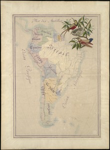
102.
Amérique du Sud
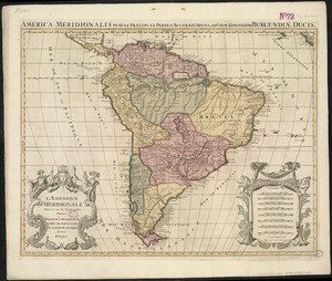
103.
L'Amerique Meridionale divisée en ses principales parties
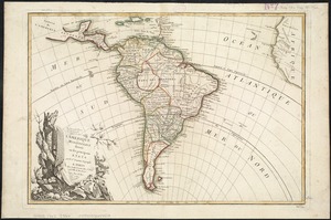
104.
L'Amerique meridionale divisée en ses principaux etats
105.
L'Amerique, meridionale, et septentrionale
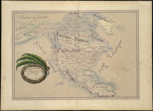
106.
[Amerique septentrionale]
107.
L'Amerique septentrionale
108.
Amérique Septentrionale
109.
Amérique Septentrionale : dressée sur les relations les plus modernes des voyageurs et navigateurs, et divisée suivant les...
110.
L'Amérique Septentrionale
111.
Amérique septentrionale
112.
Amérique Septentrionale
113.
L'Amérique Septentrionale & Meridionale divisée en ses principales parties, ou sont distingués les vns des autres les estats...
114.
Amérique septentrionale avec les routes, distances en miles, villages, et etablissements François et Anglois
115.
Amerique septentrionale divisée en ses principale parties
116.
Amerique septentrionale divisée en ses principales parties : ou sont distingués les uns des autres les etats suivant quils...
117.
L'Amérique Septentrionale divisée en ses principaux états
118.
Amherst, Mass
119.
Amplissimae regionis Mississipi seu provinciae Ludovicianae â R.P. Ludovico Hennepin Francisc. Miss. in America septentrionali...
120.
Amplissimae regionis Mississipi seu Provinciae Ludovicianae â R.P. Ludovico Hennepin Francisc Miss in America Septentrionali...
121.
Amsterdam, N.Y : 1875
122.
[An unfinished tracing of Joshua Fisher's copy on parchment of Oliver's paper plat of land in Dorchester, made in 1661]
123.
Anchorages in the Fiji Group : from British surveys ; corrected to 1872
124.
Andaluzia continens Sevillam et Cordubam
125.
Andrews's new and accurate travelling map of the roads of Scotland : shewing the distances between the towns &c
126.
Anglesey : Wight Vectis olim ; Garnesay ; Iarsay
127.
Anjou : Andegavensium ditionis vera et integra descriptio
128.
Annapolis Royal ... : St. Mary's Bay
129.
Annexation map
130.
L'Anse including Portage Entry and part of Keweenaw Bay, Lake Superior
131.
Antietam Sharpsburg and vicinity : constructed and engraved to illustrate "The war with the South"
132.
Antigua
133.
Antilles ou Indes Occidentales
134.
Antrim, N.H. and Clinton Village : 1887
135.
Apolima, Samoan Group ; Harbour of Oafonu, Isld. of Tutuila, north side ; Harbour of Aur, Isld. of Tutuila, north side ;...
136.
Appearance of Fort Sumter on Sunday afternoon, August 23d, 1863 : sketched from the "Beacon house" on Morris Island
137.
Appearance of the land from the White Islands to St. Marys River taken two leagues off shore : The entrance of Milford Haven at...
138.
Appletons' railway map of the United States and Canada
139.
Appletons' railway map of the United States and the Canadas : representing railways in actual operation, and those in the...
140.
Approaches to Fort Butte La Rose, Louisiana : captured by the U.S. fleet, co-operating with the forces under the command of...
141.
Approaches to Fort Hindman, Arkansas Post, on the Arkansas River : captured by the U.S. Mississippi Squadron, under command of...
142.
L'Arabia divisa in petrea, deserta, e felice
143.
Arabia--Red Sea, Mokha Road : from a British survey in 1882
144.
Archiepiscopatus et Electoratus Trevirensis novissima delineatio exacte divisa in omnes suas praefecturas in hac quoque tabula...
145.
Archiepiscopatus Trevirensis
146.
The archipelago of the East, being the Sunda, the Molucca, and Phillipps. Islands : the chief settlements of the Dutch in India...
147.
Archipelagus Atlanticus cum suis insulis Canariis, Hesperidibus et Azoribus
148.
Arcihiepiscopatus Cameracensis
149.
Arctic America : eastern sheet
150.
Arizona (Coconino County), Bright Angel quadrangle
‹ Prev
Next ›
1
2
3
4
5
6
7
…
81
82
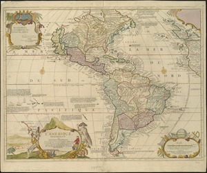
![[Amerique septentrionale]](https://bpldcassets.blob.core.windows.net/derivatives/images/commonwealth:8336h2955/image_thumbnail_300.jpg)


![[An unfinished tracing of Joshua Fisher's copy on parchment of Oliver's paper plat of land in Dorchester, made in 1661]](https://bpldcassets.blob.core.windows.net/derivatives/images/commonwealth:wd376179d/image_thumbnail_300.jpg)


