Toggle navigation
LMEC Home
Exhibitions
Georeferencing
Tools for Teachers
Collections
My Favorites
Sign Up / Log In
Search
Search the map portal
Map Collection
Map Collection
Map Sets
Search
Search
Search for
Search In
All Fields
Creator
Title
Subject
Place
Search All Digital Collections
Advanced Search
517 Results
My Search
Start Over
More Like
commonwealth:qz20w877m
Remove constraint More Like: commonwealth:qz20w877m
Filter your Search
Place
North and Central America
514
United States
511
Suffolk (county)
503
Boston
502
Massachusetts
200
Roxbury
90
South End
51
Fens
47
more
Place
»
Topic
City planning--Massachusetts--Boston--Maps
418
Urban renewal--Massachusetts--Boston--Maps
253
Boston (Mass.)--Maps
137
Land use--Massachusetts--Boston--Maps
102
Roxbury (Boston, Mass.)--Maps
89
Buildings--Massachusetts--Boston--Maps
85
Real property--Massachusetts--Boston--Maps
77
Fenway (Boston, Mass.)--Maps
48
more
Topic
»
Date
Date range begin
–
Date range end
Current results range from
1832
to
2003
View distribution
Creator
Boston Redevelopment Authority
369
Bromley, George Washington
17
Bromley, Walter Scott
17
G.W. Bromley & Co.
12
Downtown Waterfront Corporation
10
Victor Gruen Associates
10
Boston (Mass.). Parks and Recreation Department
9
Sasaki Associates
6
more
Creator
»
Format
Maps/Atlases
516
Drawings/Illustrations
3
Manuscripts
1
Prints
1
Georeferenced
Yes
6
No
511
Collection
Boston and New England Maps
505
Urban Maps
488
Boston Redevelopment Authority Collection
441
Norman B. Leventhal Map & Education Center Collection
127
Massachusetts Real Estate Atlases
4
Applied Geographics, Inc. Records
2
Mapping Boston Collection
1
Available to use
No known restrictions
511
Creative Commons license
1
Search Constraints
Sort by relevance
relevance
title
date (asc)
date (desc)
Number of results to display per page
20 per page
10
per page
20
per page
50
per page
100
per page
View results as:
grid view
map view
Search Results
421.
Plan of Boston and Roxbury
422.
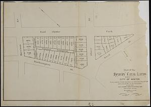
[Plan of boundary lines in Roxbury and the City of Boston]
423.
Plan of Fort Hill showing street improvements as adopted by the city council : 1869
424.
Plan of house lots in Boston belonging to Otis H. Weed
425.
Plan of land in Roxbury belonging to the heirs of Alfred Evans
426.
Plan of the Roxbury Canal lands belonging to the city of Boston to be sold by public auction on Saturday May 19th 1883 at 3...
427.
A plan of the salt marsh and upland in Roxbury, lying the east side of the Mill Creek
428.
Topographical map of Cedar Square, Roxbury
429.
Views of the area around Dudley Station in Roxbury
430.
Washington Street corridor : South Cove to Forest Hills
431.
Woodland Cemetery in Dorchester and Roxbury main entrance on Walk-Hill Street : five miles from Boylston market, direct route...
432.
660 Wakulah St., Roxbury
433.
Allston-Brighton open space plan site inventory
434.
Appleton St. Woonerf
435.
Back Bay park
436.
Boston Common - Barry Memorial
437.
Boston Common Brewer Fountain - exist. conditions, demolition plan and site plan for comfort station area
438.
Boylston Street : Fenway to Massachusetts Avenue
439.
Boylston Street improvements
440.
Brighton and Allston urban design strategy
‹ Prev
Next ›
1
2
…
18
19
20
21
22
23
24
25
26

![[Plan of boundary lines in Roxbury and the City of Boston]](https://bpldcassets.blob.core.windows.net/derivatives/images/commonwealth:1257bb127/image_thumbnail_300.jpg)