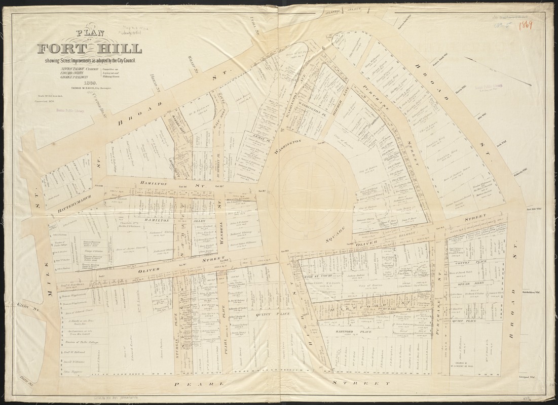
Plan of Fort Hill showing street improvements as adopted by the city council : 1869
Item Information
- Title:
- Plan of Fort Hill showing street improvements as adopted by the city council : 1869
- Creator:
- Boston (Mass.). City surveyor
- Name on Item:
-
Committee on laying and widening streets ; Thomas W. Davis.
- Date:
-
1870
- Format:
-
Maps/Atlases
- Location:
-
Boston Public Library
Norman B. Leventhal Map & Education Center - Collection (local):
-
Norman B. Leventhal Map & Education Center Collection
- Subjects:
-
Real property--Massachusetts--Boston--Maps
Land tenure--Massachusetts--Boston--Maps
Boston (Mass.)--Maps
Roxbury (Boston, Mass.)--Maps
- Places:
-
MassachusettsSuffolk (county)BostonRoxbury
- Extent:
- 1 map : col. ; 88 x 120 cm.
- Terms of Use:
-
No known copyright restrictions.
No known restrictions on use.
- Publisher:
-
Boston, Mass :
[City Council?]
- Scale:
-
Scale 1:360. 1 inch to 30 feet.
- Language:
-
English
- Notes:
-
Corrected 1870.
- Identifier:
-
06_01_003493
- Call #:
-
G3764.B6 1870 .B67
- Barcode:
-
39999059001402


