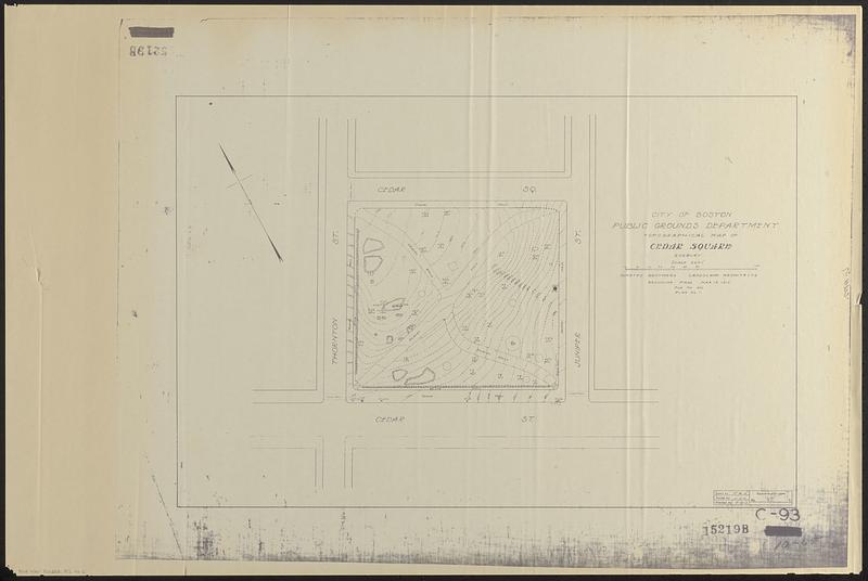
Topographical map of Cedar Square, Roxbury
Item Information
- Title:
- Topographical map of Cedar Square, Roxbury
- Cartographer:
- Olmsted Brothers
- Contributor:
- Boston (Mass.). Public Grounds Department
- Name on Item:
-
drawn by T.W.S. ; traced by J.J.C. ; checked by T.W.S.
- Date:
-
1913
- Format:
-
Maps/Atlases
- Location:
-
Boston Public Library
Norman B. Leventhal Map & Education Center - Collection (local):
-
Norman B. Leventhal Map & Education Center Collection
- Series:
- Boston Redevelopment Authority Maps & Manuscript Plans Collection
- Subjects:
-
Roxbury (Boston, Mass.)--Maps
Parks--Massachusetts--Boston--Maps
- Places:
-
MassachusettsSuffolk (county)BostonRoxbury
- Extent:
- 1 map photocopy ; 44 x 67 cm
- Terms of Use:
-
No known copyright restrictions.
No known restrictions on use.
- Publisher:
-
Brookline, Mass. :
Olmsted Brothers
- Scale:
-
Scale 1:240. 20'=1"
- Language:
-
English
- Notes:
-
Photocopy of a plan of Cedar Square Park in Roxbury.
Relief shown by contours and spot heights.
Oriented with north to the upper left.
"File no. 950. Plan no. 1."
"15219B."
- Identifier:
-
06_01_018566
- Call #:
-
BRA MAP FOLDER 52 no.2
- Barcode:
-
30000008307636


