Toggle navigation
LMEC Home
Exhibitions
Georeferencing
Tools for Teachers
Collections
My Favorites
Sign Up / Log In
Search
Search the map portal
Map Collection
Map Collection
Map Sets
Search
Search
Search for
Search In
All Fields
Creator
Title
Subject
Place
Search All Digital Collections
Advanced Search
513 Results
My Search
Start Over
More Like
commonwealth:q524nf16p
Remove constraint More Like: commonwealth:q524nf16p
Filter your Search
Place
North and Central America
452
United States
326
New York
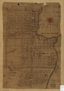
41
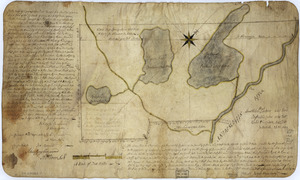
District of Columbia
30
Washington
29
Florida
19
Canada
17
Alabama
15
more
Place
»
Topic
Manuscript maps--Early works to 1800
92
Washington (D.C.)--Maps
31
Manuscript maps
21
Gulf Coast (U.S.)--Maps, Manuscript--Early works to 1800
12
Fortification--New York (State)--New York--Maps--Early works to 1800
11
New York (N.Y.)--Buildings, structures, etc--Maps, Manuscript--Early works to 1800
9
New York (N.Y.)--Maps, Manuscript--Early works to 1800
8
Saratoga Campaign, N.Y., 1777--Maps, Manuscript--Early works to 1800
8
more
Topic
»
Date
Date range begin
–
Date range end
Current results range from
1700
to
1926
View distribution
Creator
Hills, John, (Surveyor)
18
Montrésor, John, 1736-1799
16
Bingham, William, 1752-1804
12
Adlum, John, 1759-1836
10
Washington, George, 1732-1799
9
Faden, William, 1749-1836
7
Morgan, Benjamin, (Draftsman)
7
Wangenheim, Friedrich Adam Julius von
7
more
Creator
»
Format
Maps/Atlases
511
Manuscripts
475
Objects/Artifacts
2
Georeferenced
Yes
13
No
500
Collection
American Revolutionary War-Era Maps
484
Library of Congress Collection
480
Maritime Charts and Atlases
30
Norman B. Leventhal Map & Education Center Collection
29
Urban Maps
19
William L. Clements Library Collection
2
MacLean Collection Map Library
1
New York Public Library Collection
1
Available to use
Creative Commons license
481
No known restrictions
29
Search Constraints
Sort by relevance
relevance
title
date (asc)
date (desc)
Number of results to display per page
20 per page
10
per page
20
per page
50
per page
100
per page
View results as:
grid view
map view
Search Results
21.
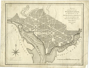
Plan of the city of Washington, in the territory of Columbia, ceded by the States of Virginia and Maryland to the United States...
22.
Plan of the city of Washington; now building for the metropolis of America, and established as the permanent residence of...
23.
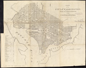
Plan of the city of Washington, seat of government of the United States
24.
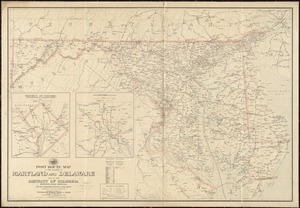
Post route map of the states of Maryland and Delaware and of the District of Columbia showing post offices with the...
25.
Post route map of the states of Pennsylvania, New Jersey, Delaware, and Maryland and of the District of Columbia with adjacent...
26.
Rand, McNally & Co.'s indexed atlas of the world : map of Washington, D.C
27.
Rand McNally standard map of Washington D.C.
28.
Scarborough's new county and post office map of Virginia, Maryland, Delaware, and District of Columbia : with complete index...
29.
The seat of war : birds eye view of Virginia, Maryland, Delaware, and the District of Columbia
30.
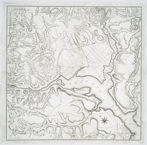
Territory of Columbia
31.
Topographical map of the District of Columbia
32.
The tourist's pocket map of the state of Virginia : exhibiting its internal improvements, roads, distances &c
33.
Washington and vicinity
34.
1st. & 2d. position of that part of the army engaged on the 19th Sept. 1777 : 3d & 4th postn. Sept. 19
35.
20 tracts, Charleston
36.
20 tracts, Tioga County
37.
The Above is a plan of the town of Cabot, State of Vermont
38.
The above plan is a discription of a new township called Royalsborough in the county of Cumberland : bounded southeasterly on...
39.
The above plan is a discription of a new township containing the quantity of seven and a half mile of land & water, granted by...
40.
An accurate map of His Majesty's Province of New-Hampshire in New England & all the adjacent country northward to the River St....
‹ Prev
Next ›
1
2
3
4
5
6
…
25
26